
Contour Lines - Definition, Examples, Quiz, FAQ, Trivia
Learn how to read topographic maps and understand elevation changes
What are Contour Lines?
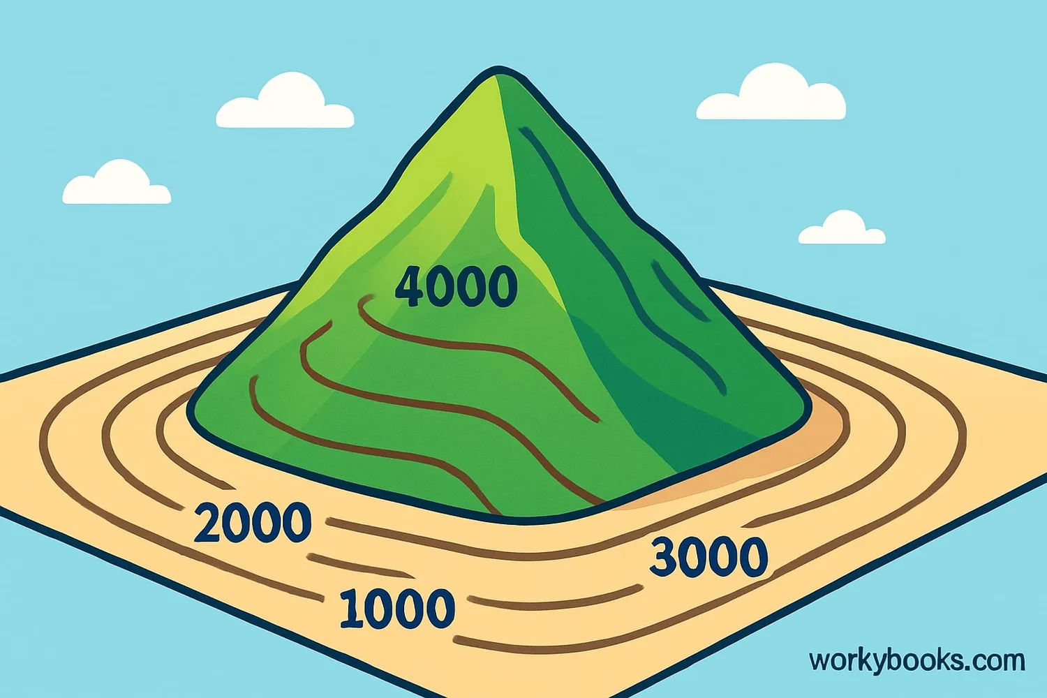
Contour lines are special lines on maps that show the shape and elevation of the land. Each contour line connects points that are at the same height above sea level. Think of them like the rings on a tree trunk - each ring shows a different level.
These lines help us visualize hills, valleys, mountains, and other terrain features on a flat map. The closer together the lines are, the steeper the slope. When lines are far apart, the land is relatively flat.
Cartography Fact!
The first known use of contour lines was by Dutchman Pieter Bruinsz in 1584 to show the depths of a river!
How to Read Contour Lines
Reading contour lines is like solving a puzzle about the land's shape. Here's what you need to know:
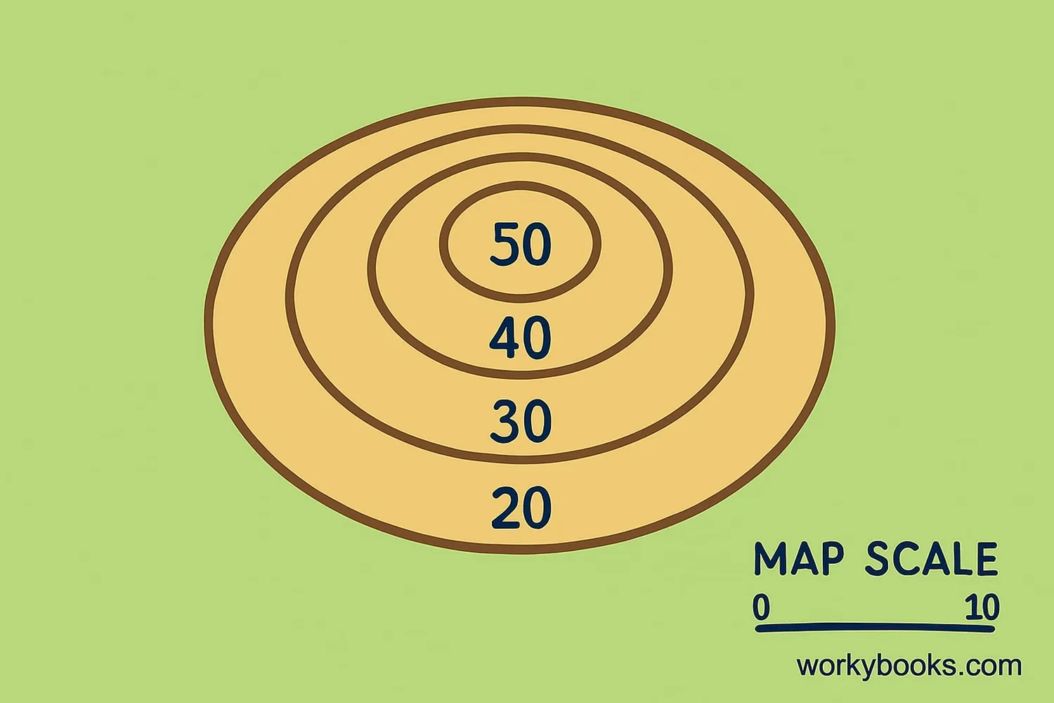
Contour Interval
The height difference between lines (e.g., 10 feet between lines)
Index Lines
Every 5th line is thicker and labeled with elevation
Slope Steepness
Close lines = steep slope, far lines = gentle slope
Hills & Depressions
Concentric circles show hills, circles with hachures show depressions
Ridges & Valleys
V-shaped lines point upstream in valleys, away from ridge tops
The key to understanding contour lines is to remember they always form closed loops, never cross each other, and show the continuous elevation of the land. With practice, you can visualize the 3D landscape just by looking at these lines!
Elevation Clues!
When contour lines form V shapes, the point of the V always points uphill. This helps identify the direction water would flow!
Why Contour Lines Matter
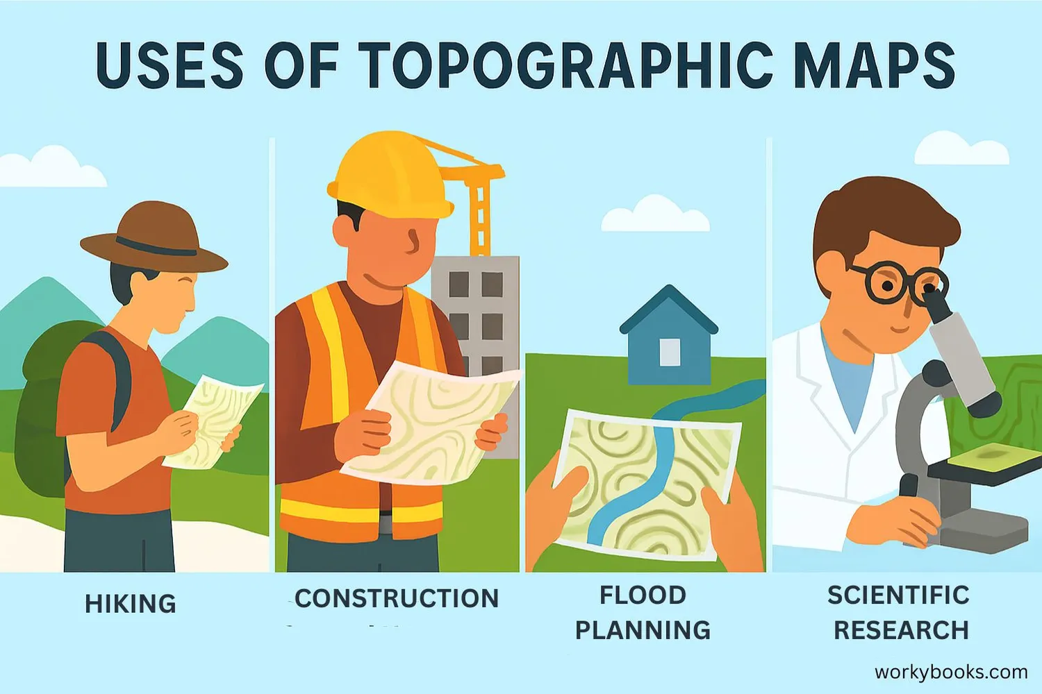
Contour lines are essential tools for understanding and navigating our world. They help us in many ways:
Outdoor Activities
Hikers and campers use them to plan routes and avoid steep terrain
Construction
Engineers use them to design roads, buildings, and drainage systems
Flood Control
Predicting flood areas and planning flood prevention measures
Without contour lines, we wouldn't be able to:
• Plan safe hiking and climbing routes
• Design effective drainage and irrigation systems
• Build stable structures on sloped land
• Predict how water will flow during heavy rains
• Understand geological formations and land development
Contour lines are fundamental to geography, earth science, and many practical applications in our daily lives.
Map Reading Quiz
Test your understanding of contour lines with this map reading quiz. Answer all 5 questions to see how well you understand topographic maps.
Frequently Asked Questions
Here are answers to common questions about contour lines:
Contour Lines Trivia
Discover fascinating facts about contour lines and mapping:
Highest Point
Mount Everest's summit is represented by a contour line at 8,848 meters (29,029 feet) above sea level - the highest contour line on Earth!
Surveying History
The Great Trigonometric Survey of India took over 60 years (1802-1863) and resulted in the first accurate contour maps of the Himalayan mountains.
Modern Mapping
Today, satellites can map contour lines of entire continents in days, a process that once took teams of surveyors decades to complete manually.
Ocean Depths
The Mariana Trench has contour lines showing depths greater than 10,916 meters (35,814 feet) - deeper than Mount Everest is tall!
