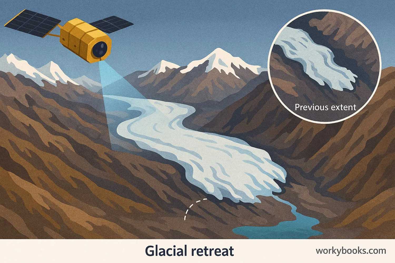
This 400-500 word informational science passage for middle school students (grades 6-8) explains how satellites track melting glaciers and ice sheets from space. Aligned with NGSS standard MS-ESS3-5, the passage explores how orbiting satellites photograph and measure Earth's ice repeatedly over decades, revealing evidence of climate change. Students learn about remote sensing technology, glacier retreat, ice sheet thinning, and the albedo effect. The passage connects satellite observations to rising global temperatures and sea levels. Audio-integrated content includes the main passage, a simplified differentiated version for struggling readers, Spanish translations of both versions, glossary terms, multiple-choice comprehension questions, writing activities requiring scientific explanation, and graphic organizers for analyzing cause-and-effect relationships. This comprehensive resource helps students understand how scientists gather evidence about climate change and the factors causing global temperature rise over the past century.
Written by Workybooks TeamPublished by Workybooks
Preview
Sample passage and quiz content
CONTENT PREVIEW
Expand content preview
Satellite data reveals important patterns in ice loss. Evidence shows that glacier retreat has accelerated over the past century.
From hundreds of miles above Earth, satellites give scientists a powerful tool to study climate change. These orbiting instruments photograph and measure the same glaciers, ice sheets, and sea ice over and over. Scientists compare images taken years apart to watch ice shrinking across the planet. This steady observation provides clear evidence of global warming.
Satellites use remote sensing technology to collect data without touching the ice. Cameras capture visible light images showing glacier boundaries and surface features. Other instruments measure ice thickness using radar waves that penetrate the surface. Scientists track glaciers retreating up mountain valleys and Arctic sea ice covering less area each summer. Large ice sheets in Greenland and Antarctica show thinning in satellite measurements. The power of satellites lies in consistency and coverage. The same instruments watch the whole Earth steadily over decades.
Satellite data reveals important patterns in ice loss. Evidence shows that glacier retreat has accelerated over the past century. In Alaska, glaciers have lost billions of tons of ice since satellites began monitoring in the 1970s. Satellites also measure rising sea levels as melting ice adds water to oceans. Ocean temperature sensors on satellites detect warming waters that melt ice from below. These multiple measurements help scientists understand the factors driving climate change.
The connection between ice loss and warming creates a feedback loop. As bright ice disappears, darker surfaces underneath absorb more heat. This process involves albedo, which measures how much sunlight a surface reflects. Ice has high albedo and reflects most sunlight back to space. Dark ocean water or rock has low albedo and absorbs heat. When ice melts, Earth's overall albedo decreases. The planet absorbs more solar radiation, causing additional warming and more ice melt.
Understanding ice loss matters for predicting future climate changes. Melting glaciers and ice sheets contribute to sea level rise that can affect coastal communities. Satellite observations provide the long-term data scientists need to track these changes. This evidence helps researchers ask better questions about what factors have caused rising global temperatures. Satellites give us eyes in the sky to monitor our changing planet.
Interesting Fact: Some satellites can detect ice thickness changes as small as one centimeter from space. This precision helps scientists measure even gradual melting over time.
What do satellites use to collect data about glaciers without touching them?
According to the passage, what has happened to glaciers in Alaska since the 1970s?
They have grown largerThey have stayed the same sizeThey have lost billions of tons of iceThey have moved to different locations
What does albedo measure?
The thickness of ice sheetsHow much sunlight a surface reflectsThe speed of glacier movementThe temperature of ocean water
Why is the consistency of satellite observations important for studying climate change?
It allows scientists to compare the same locations over many yearsIt makes satellites cheaper to operateIt helps satellites fly fasterIt reduces the number of scientists needed
How does the melting of ice create a feedback loop that causes more warming?
Melting ice releases greenhouse gases into the atmosphereDark surfaces exposed by melting ice absorb more heat, causing more meltingMelting ice makes satellites work betterIce melting causes clouds to form
Based on the passage, which statement best describes how satellites help scientists study climate change?
They provide short-term weather forecastsThey collect consistent, long-term data about ice and ocean changes across the whole planetThey prevent glaciers from meltingThey measure only the temperature of the air
What can scientists detect by comparing satellite images taken years apart?
Daily weather changesIce shrinking and glacier retreatThe exact age of glaciersThe color of ocean water
Ice has a high albedo, which means it reflects most sunlight back to space.
TrueFalse
Satellites can only measure ice thickness but cannot take photographs of glaciers.
TrueFalse
According to the passage, melting glaciers and ice sheets contribute to sea level rise.