
Elevation - Definition, Examples, Quiz, FAQ, Trivia
Discover how height above sea level shapes our world
What is Elevation?
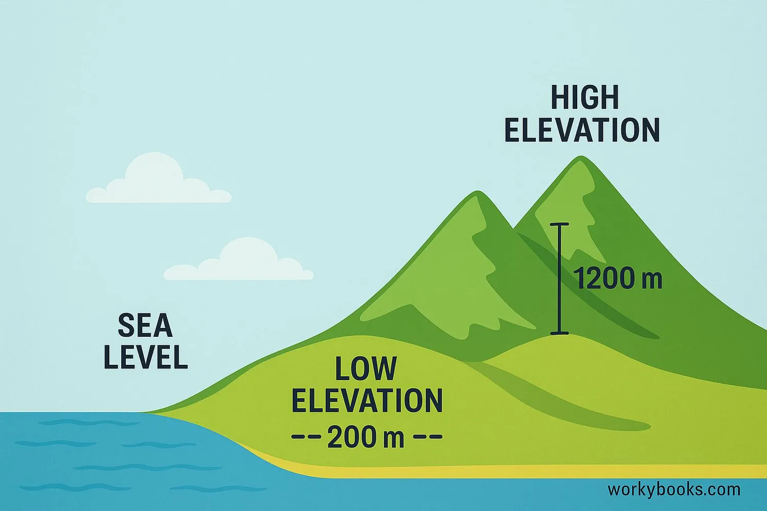
Elevation is the height of a point above sea level. It tells us how high or low a place is compared to the average level of the ocean.
Think of elevation as Earth's natural staircase. Some places like mountains have high elevation, while valleys and coastal areas have lower elevation. The highest point on Earth is Mount Everest at 8,848 meters above sea level, while the lowest land point is the Dead Sea shore at about 430 meters below sea level!
Altitude vs. Elevation
Altitude refers to height above ground level (like for airplanes), while elevation always measures height above sea level.
Measuring Elevation
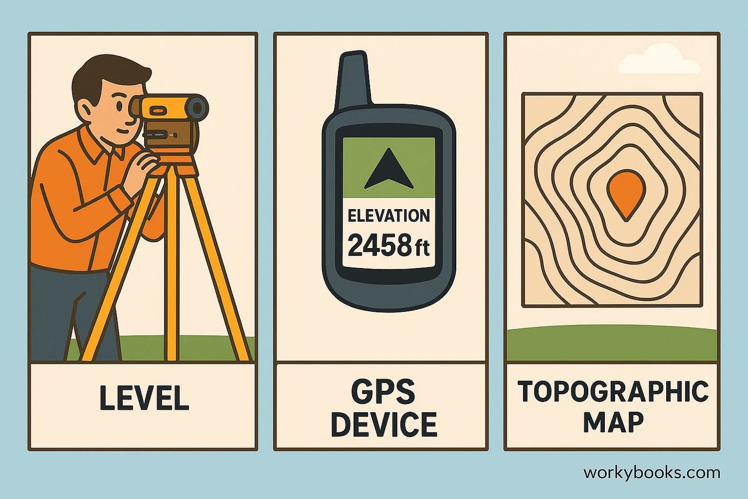
Scientists and geographers use several methods to measure elevation:
Survey Equipment
Traditional tools like levels and theodolites measure height differences
GPS Technology
Satellites calculate elevation by measuring distance from space
Digital Models
DEM (Digital Elevation Models) create 3D maps of Earth's surface
Radar & Lidar
Airplanes use lasers and radar to map elevation precisely
Topographic maps use contour lines to show elevation. Each line connects points at the same height. When lines are close together, it means the slope is steep. When lines are far apart, the land is flatter.
Bathymetry
Underwater elevation is called bathymetry. Special sonar equipment measures ocean floor depths, creating topographic maps of the seafloor.
Topography & Terrain

Topography refers to the arrangement of natural and artificial physical features of an area. It includes all the ups and downs of the land surface - what we call terrain.
Elevation creates different types of terrain:
Mountains
High elevation landforms with steep slopes and peaks
Valleys
Low areas between mountains or hills
Plateaus
Flat elevated areas with steep sides
Ocean Trenches
Deep underwater canyons with very low elevation
Geological features like mountains and valleys form over millions of years through processes like plate tectonics, volcanic activity, and erosion. Elevation differences create diverse habitats for plants and animals.
Why Elevation Matters
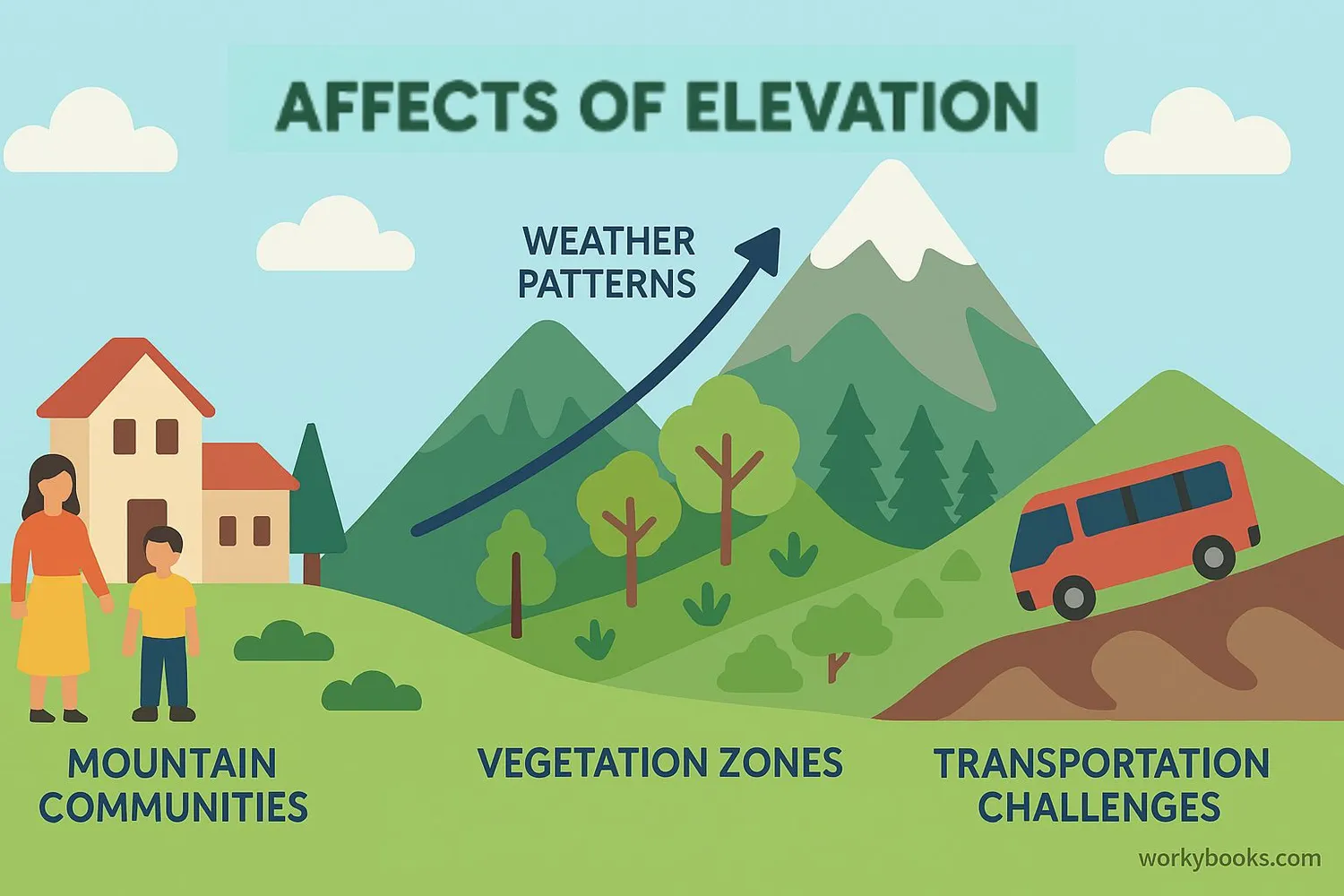
Elevation affects many aspects of our world in important ways:
Climate
Temperature drops about 6.5°C for every 1,000 meters gained
Precipitation
Mountains force air upward, creating rain on windward slopes
Ecosystems
Different elevation zones support unique plants and animals
Elevation impacts human activities too:
• Agriculture: Different crops grow at different elevations
• Transportation: Mountain roads and tunnels require special engineering
• Settlement: Most cities develop at lower elevations
• Aviation: Pilots need to know terrain elevation for safe flights
Understanding elevation helps us predict weather patterns, plan cities, protect ecosystems, and prepare for natural hazards like floods.
Elevation Quiz
Test your elevation knowledge with this quiz! Answer all 5 questions to see how much you've learned.
Frequently Asked Questions
Here are answers to common questions about elevation:
Elevation Trivia
Discover amazing facts about elevation around the world:
Tallest Mountain
Mauna Kea in Hawaii is Earth's tallest mountain from base to peak. While only 4,207m above sea level, it extends 10,200m below the ocean surface - taller than Mount Everest!
Deepest Point
The Mariana Trench in the Pacific Ocean is the deepest point on Earth at 10,994m below sea level. That's deeper than Mount Everest is tall!
Highest City
La Rinconada in Peru is the highest permanent settlement at 5,100m elevation. Residents experience only about half the oxygen available at sea level.
Planetary Extremes
Olympus Mons on Mars is the tallest known mountain in our solar system at 21.9km high - nearly 2.5 times taller than Mount Everest!
