Color the Climate Zones
Interactive worksheet with auto-grading, instant feedback, and printable PDF.
- Format
- Interactive (Online), Printable (PDF)
- Grades
- 345
- Subjects
- sciencesocial studies
- Standards
- NGSS 3-ESS2-2
What's included
About this worksheet
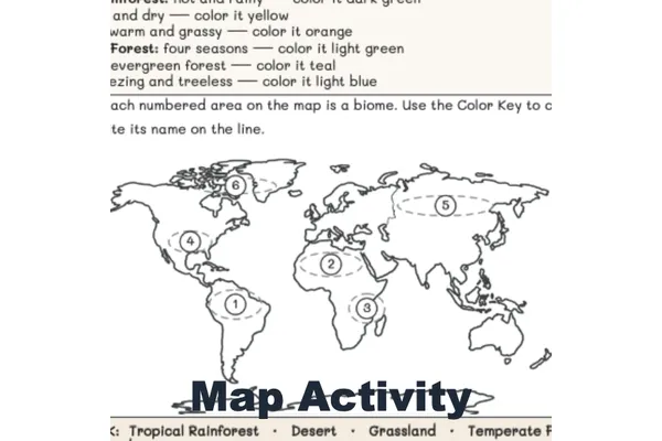
Color the Climate Zones! turns a world map into a hands-on climate lesson your third graders will love. Students color Earth's three climate zones—tropical, temperate, and polar—and discover the big pattern: the closer to the equator, the hotter, and the closer to the poles, the colder.
In Step 1, students use a Color Key to color each labeled band on a clean world map, with the equator and zone lines already marked for them. In Step 2, they use the map and a word bank to finish sentences about the equator, the three zones, and how the climate changes as you move from the equator toward the poles, then explain the big idea in their own words.
This no-prep printable supports NGSS 3-ESS2-2 (comparing the climates of different regions) with a natural geography crossover—continents, the equator, and latitude.
What's included:
- A two-page worksheet: color the world map, then find the pattern
- A Color Key, fill-in questions, and a Big Idea writing prompt
- A complete answer key with the map shown fully colored
Great for science centers, geography lessons, or a weather-and-climate unit. Just print and color!
Perfect for the way you teach
- Assign in one click
- Track progress per student
- Auto-graded results
- Practice at home
- Print or do on-screen
- Build skill mastery
- Standards-aligned
- Self-paced
- Ready-to-use today