
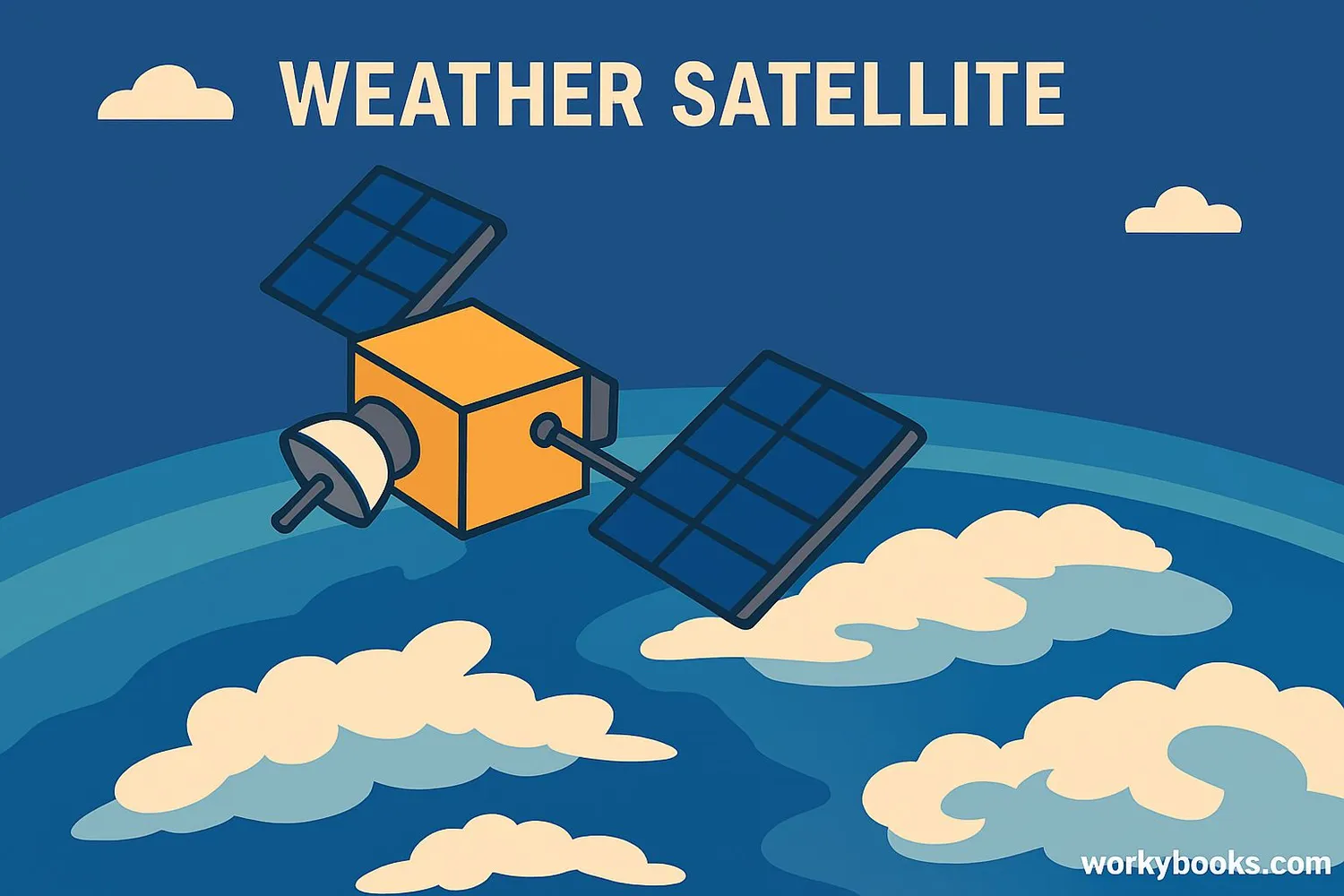
Weather Satellite - Definition, Examples, Quiz, FAQ, Trivia
Discover how scientists observe weather patterns from space
What is a Weather Satellite?
A weather satellite is a special spacecraft that orbits Earth and takes pictures of our planet's atmosphere. These satellites help scientists monitor weather patterns, track storms, and predict future weather conditions.
Weather satellites are like giant cameras in space that can see clouds, storms, and even temperature changes across the entire planet. They provide crucial information for weather forecasts that help us plan our daily activities and prepare for severe weather.
Did You Know?
The first weather satellite, TIROS-1, launched in 1960 and sent back 23,000 pictures of Earth's weather during its 78-day mission!
How Weather Satellites Work
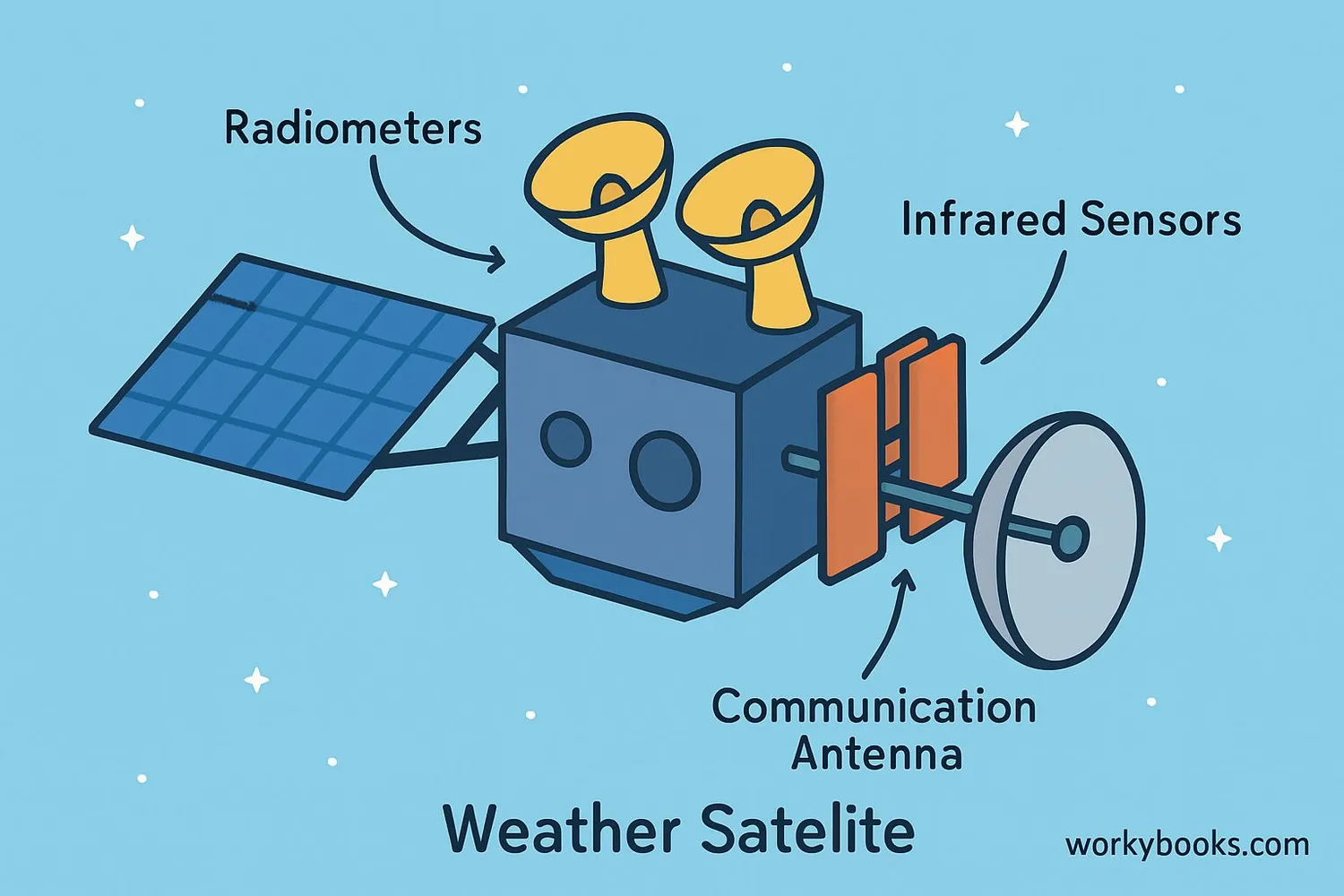
Weather satellites use special instruments to observe Earth's atmosphere and surface. These instruments measure different aspects of weather:
Radiometers
Measure visible light and infrared radiation to create images of clouds and storms
Infrared Sensors
Detect heat energy to measure cloud temperatures and surface conditions
Scatterometers
Measure wind speed and direction over oceans
Microwave Sensors
See through clouds to measure rainfall and moisture
Data Transmission
Satellites send information to ground stations for weather forecasting
The satellites capture images every few minutes, creating time-lapse sequences that show how weather systems develop and move. This information helps meteorologists create accurate weather forecasts.
Technology Spotlight
The GOES-16 satellite can take a picture of the entire Western Hemisphere every 15 minutes and a picture of the continental U.S. every 5 minutes!
Types of Weather Satellites
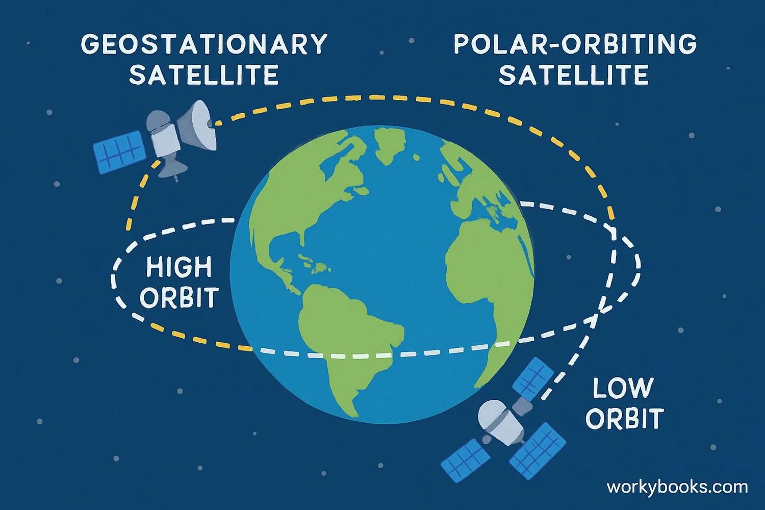
There are two main types of weather satellites that work together to give us a complete picture of Earth's weather:
Geostationary Satellites
• Orbit 22,236 miles above Earth
• Stay fixed over one location
• Provide continuous images of the same area
• Examples: GOES-16, GOES-17
Polar-Orbiting Satellites
• Orbit 500 miles above Earth
• Circle from pole to pole
• Provide global coverage twice daily
• Examples: NOAA-20, MetOp satellites
Small Satellites
• Miniature satellites called CubeSats
• Lower cost, easier to launch
• Provide specialized weather data
• Future of weather observation
Geostationary satellites are great for watching storms develop in real-time, while polar-orbiting satellites provide detailed global data that helps with long-range forecasting and climate studies.
Why Weather Satellites Matter
Weather satellites provide crucial information that helps us in many ways:
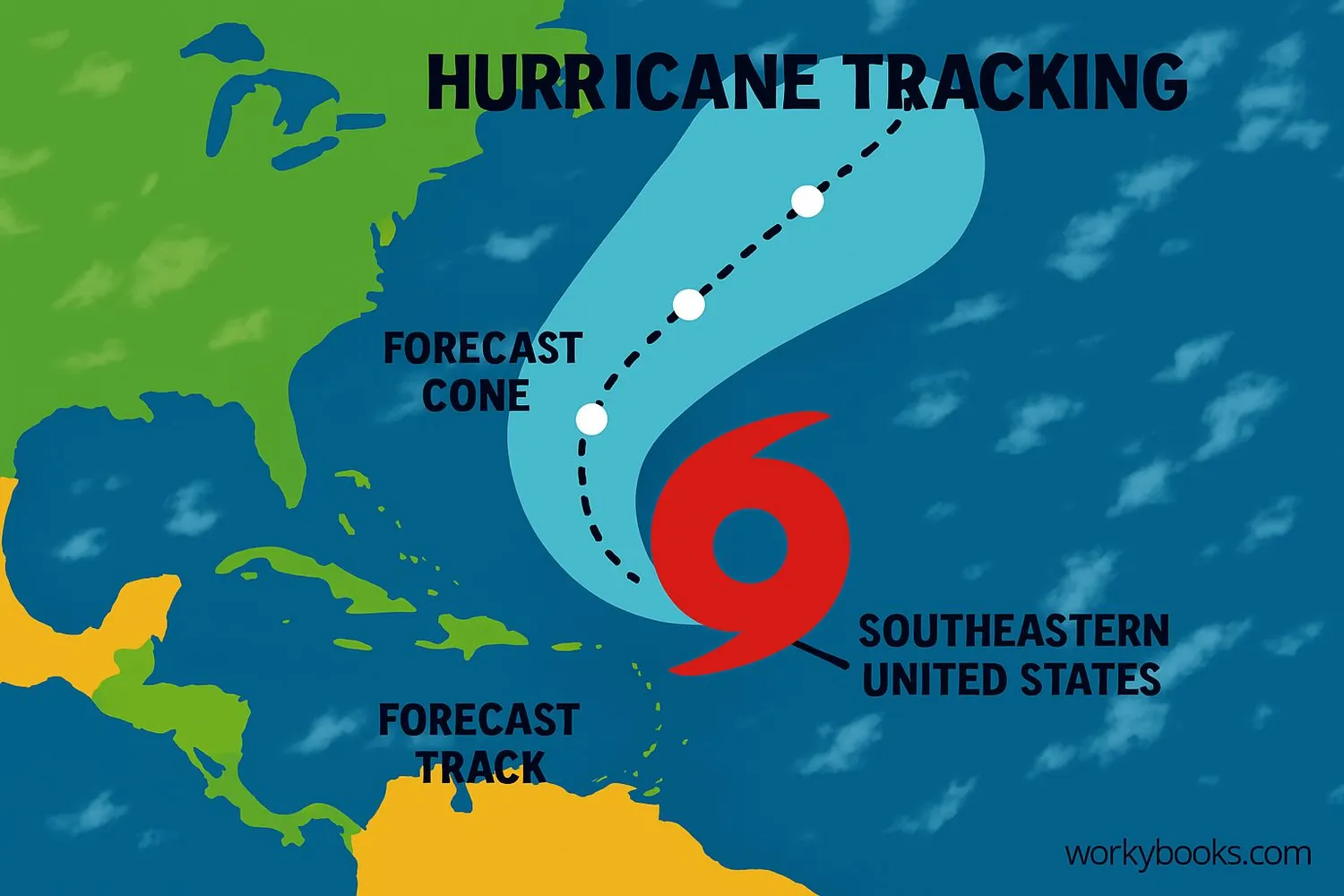
Storm Tracking
Monitor hurricanes, tornadoes, and blizzards to provide early warnings
Daily Forecasts
Provide data for your local weather report and 10-day forecast
Climate Monitoring
Track long-term climate patterns and environmental changes
Without weather satellites, we wouldn't have:
• Accurate 5-10 day weather forecasts
• Early warnings for dangerous storms
• Global views of weather patterns
• Long-term climate data
Weather satellites have improved forecast accuracy by 50% over the past 30 years, saving lives and helping us prepare for changing weather conditions.
Life-Saving Technology
Satellite warnings before Hurricane Katrina helped evacuate 1.2 million people, saving thousands of lives.
Weather Satellite Quiz
Test your knowledge about weather satellites with this quiz!
Frequently Asked Questions
Here are answers to common questions about weather satellites:
Weather Satellite Trivia
Discover fascinating facts about weather satellites:
Speedy Imaging
The GOES-16 satellite can scan the Western Hemisphere every 15 minutes, the continental U.S. every 5 minutes, and specific storm areas as often as every 30 seconds!
Incredible Resolution
Modern weather satellites can see objects as small as 0.5 km across from 22,000 miles away. That's like spotting a baseball from 400 miles away!
Massive Data Collection
Weather satellites generate over 100 terabytes of data every day - enough to fill 20,000 DVDs! This data helps create your daily weather forecast.
Historic First Image
The first weather satellite image from TIROS-1 in 1960 showed the coast of Maine and Canada. It was blurry by today's standards but revolutionized weather forecasting.
