How Air Pressure Creates Wind: A Simple Explanation
Have you ever felt a cool breeze on your face? That breeze is wind. But where does wind come from? The answer starts with something invisible: air pressure. We will explore exactly how air pressure creates wind.
What Is Air Pressure?
Air is all around us, even though we cannot see it. Air is made of tiny particles called molecules. These molecules are always moving and pushing on everything they touch. This pushing force is called air pressure.
Think of air like a crowd of people in a room. When many people squeeze into a small space, there is a lot of pushing. When only a few people are in the room, there is less pushing. Air works the same way. More air molecules packed together means higher pressure. Fewer air molecules means lower pressure.
How the Sun Changes Air Pressure
Here is where it gets interesting. The Sun does not heat Earth evenly. The equator gets strong, direct sunlight. The poles get weak, slanted sunlight. Even in your town, a dark parking lot heats up faster than a grassy park.
When the Sun warms the air, the molecules speed up and spread apart. This warm air becomes lighter and rises, like a bubble rising through water. As the warm air rises, it leaves behind an area of low pressure.
Cool air is different. Its molecules move slower and stay closer together. Cool air is heavier, so it sinks toward the ground. Sinking air piles up and creates an area of high pressure.
How Air Pressure Creates Wind: From High to Low
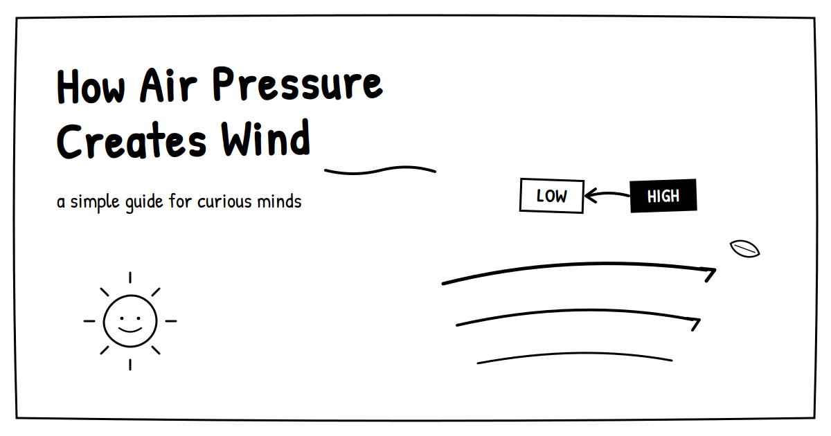
Now for the big idea. Air always moves from high pressure to low pressure. It is like air trying to even things out.
Imagine squeezing a balloon and letting go of the opening. The air inside is at high pressure. The air outside is at lower pressure. Whoosh! The air rushes out from high to low. That rushing air is just like wind.
The same thing happens in our atmosphere every day. Air flows from high-pressure areas toward low-pressure areas. That moving air is what we call wind.
Scientists have a name for this push: the pressure gradient force. It simply means the force created by a pressure difference.
Why are some winds stronger than others?
The strength of wind depends on the pressure difference. A big difference in pressure creates fast, strong winds. A small difference creates gentle breezes.
Think of a slide at the playground. A steep slide makes you zoom down fast. A gentle slide moves you slowly. Pressure differences work the same way with wind.
This is why storms are so windy. A storm has very low pressure at its center. The bigger the difference from the air around it, the harder the wind blows.
How Do We Know This Is True?
Scientists do not just guess. They measure!
Weather scientists, called meteorologists, use tools called barometers to measure air pressure. On weather maps, they draw lines connecting places with equal pressure. When those lines are close together, the pressure changes quickly. And guess what? Those are exactly the places with strong winds. When the lines are far apart, the winds are calm.
Sailors figured out part of this long ago. When their barometer readings dropped, they knew windy, stormy weather was coming. The evidence has matched the science for hundreds of years.
You can even see it at home. Open a door just a crack between a warm room and a cold hallway. Hold a tissue near the top of the gap, then near the bottom. The tissue often flutters in opposite directions! Warm air sneaks out the top while cool air flows in at the bottom. That is a tiny wind, made by a pressure difference in your own house.
How Do Meteorologists Use Air Pressure?
Because pressure differences drive wind and weather, meteorologists watch pressure closely — it’s one of the most important readings in weather forecasting. Among their weather instruments is the barometer, which measures air pressure, and they map those readings by drawing lines called isobars that connect points of equal pressure. Where isobars are packed tightly together, the pressure gradient is steep, and the winds are strong; where isobars spread far apart, the winds are light.
A change in pressure is an especially useful clue. A falling barometer often signals an approaching low-pressure system and the unsettled, windier weather that comes with it — a pattern sailors relied on for centuries before the physics was fully understood. The large H and L symbols on a weather map mark those high- and low-pressure centers — the cores of the weather systems that move across a region — helping forecasters predict where air will head next.
A Real-Life Example: The Sea Breeze
Have you ever been to the beach on a sunny day? You probably felt a breeze blowing from the ocean toward the land.
Here is why. During the day, land heats up faster than water. The warm air over the land rises, creating low pressure. The air over the cool ocean stays at higher pressure. So the cooler ocean air flows toward the land. That is the sea breeze!
At night, the opposite happens. Land cools down faster than water. Then the breeze blows from the land toward the sea. This gentler nighttime flow is called a land breeze.
The same idea works on a giant scale, too. Huge seasonal winds called monsoons are like sea breezes the size of a continent. Even the winds that circle our whole planet begin with one big pressure difference: hot air at the equator and cold air at the poles.
Common Misconceptions About Wind and Air Pressure
“Wind happens because warm air blows toward cold air.” Not quite. The air you feel is usually the cooler, denser air moving in to replace air that has risen elsewhere. The immediate cause is the pressure gradient, not warm air traveling sideways.
“Low pressure pulls air toward it.” Low pressure is a destination, not a magnet. Air is pushed toward it by the higher pressure behind — there is no vacuum-like pulling force.
“High pressure always means warm, sunny weather.” High pressure often brings clear skies, but not always warmth. A winter high-pressure system can deliver bitterly cold, clear days. Pressure and temperature are related but not the same thing.
“Wind always moves in a straight line from high to low pressure.” Because of the Coriolis effect and surface friction, wind usually curves rather than traveling in a straight path, especially across large distances
Let’s Review
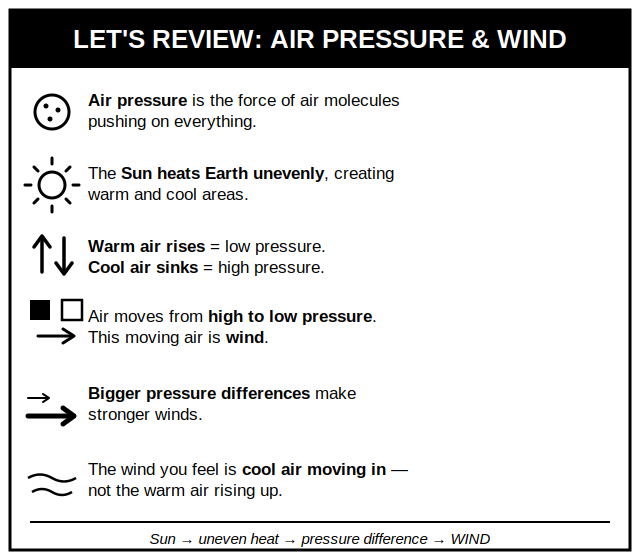
- Air pressure is the force of air molecules pushing on everything.
- The Sun heats Earth unevenly, creating warm and cool areas.
- Warm air rises and creates low pressure. Cool air sinks and creates high pressure.
- Air moves from high pressure to low pressure. This moving air is wind.
- Bigger pressure differences make stronger winds.
- The wind you feel is cool air moving in — not the warm air rising up.
Think About It
Next time you feel the wind, remember what is really happening. Somewhere, the Sun warmed the air and changed the pressure. The air is simply rushing to even things out. Wind is nature’s way of balancing the atmosphere, one breeze at a time!
Related Posts

What Are Scientific Method for Kids
All about Earthquake for Your Classroom: Worksheets and Activities