Premium
Weather Maps and Forecasting
Interactive passage with audio narration, comprehension questions, and printable PDF.
Just this resource
$1.50
One-time purchase
Best value
Unlock everything
$49.99$29.99/yr
40% off until Aug 1 — 6,000+ resources
Unlock above to use these actions
- Format
- Interactive (Online), Printable (PDF)
- Grades
- 5678
- Subjects
- scienceela
- Standards
- MS-ESS2-5MS-ESS3-2
- Languages
- English, Spanish
What's included
Reading passage
Reading comprehension
Audio narration
With word word highlighting
Comprehension quiz
Auto-graded
Writing activity
Open-ended response
Glossary & flashcards
Vocabulary practice
Differentiated version
Adapted for varied levels
Spanish translation
Bilingual support
About this reader
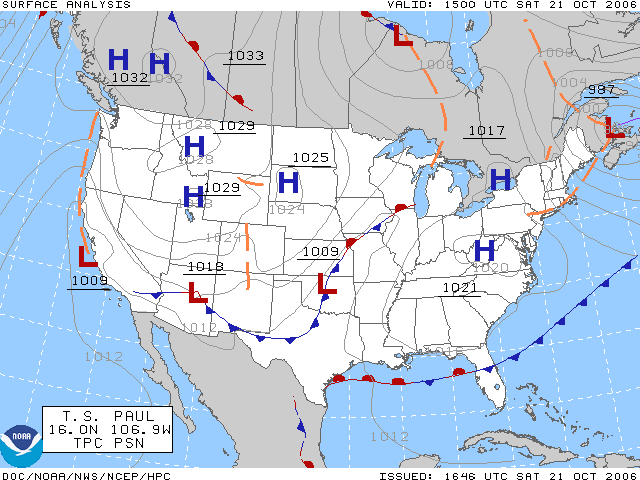
This comprehensive middle school science passage explores how weather maps and forecasting work, directly aligning with NGSS standards MS-ESS2-5 and MS-ESS3-2. Students will learn how meteorologists use weather map symbols, such as high and low pressure systems and fronts, as well as station models that show temperature, wind, and precipitation. The passage explains the mechanisms behind weather prediction, including the use of surface and upper-air observations, radar, satellites, and computer models. It also addresses the limits of forecast accuracy and the importance of probability and severe weather warnings. With a Lexile range of 750-850, this passage is designed for grades 6-8 and integrates academic vocabulary, real-world examples, and cause-and-effect explanations. The resource includes a glossary, differentiated/simplified version, Spanish translations, comprehension and writing activities, and graphic organizers. Audio integration supports diverse learners. Keywords: weather maps, forecasting, meteorology, atmospheric data, radar, computer models.
Written by Workybooks TeamPublished by Workybooks
Preview
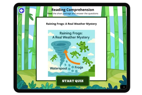
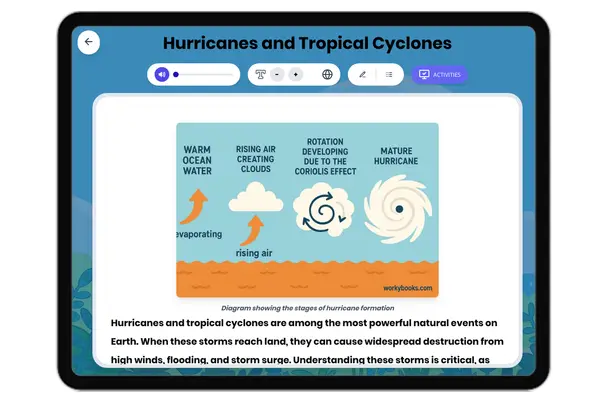
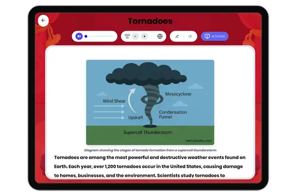
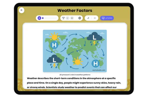
Sample passage and quiz content
Who it's for
Perfect for the way you teach
Teachers
- Build comprehension skills
- Auto-graded quiz
- Differentiated reading
Parents
- Read together at home
- Improve fluency
- Quiet reading time
Homeschoolers
- Reading curriculum support
- Independent practice
- Track Lexile growth
Topics
weather mapsforecastingmeteorologyfrontspressure systemsstation modelsradarcomputer models