
Coordinate Systems - Definition, Examples, Quiz, FAQ, Trivia
Learn how to navigate maps and graphs with Cartesian, polar, and geographic coordinates
What is a Coordinate System?
A coordinate system is like a special map that helps us find the exact location of a point. Think of it as giving directions to your friend about where to find a hidden treasure!
All coordinate systems have:
- Axes: These are reference lines (like the x-axis and y-axis in a grid)
- Origin: The starting point where the axes cross (0,0)
- Coordinates: Numbers that tell us how far to move from the origin
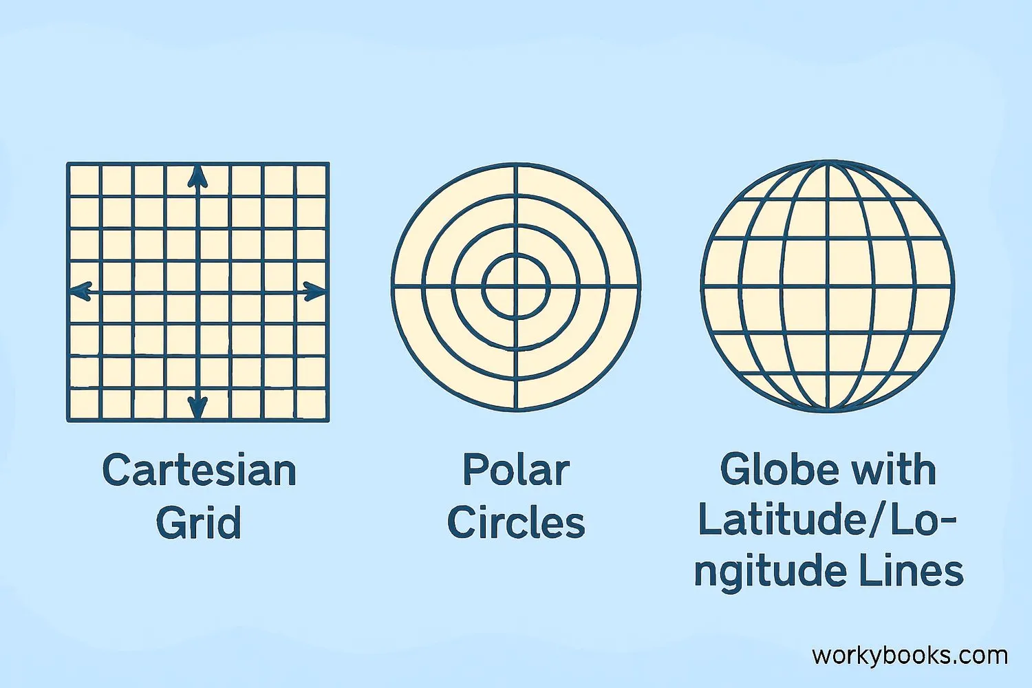
We use different coordinate systems for different purposes. The three main types are:
- Cartesian: Uses a grid with x and y axes (great for graphs)
- Polar: Uses distance and angle from a center point (like a radar screen)
- Geographic: Uses latitude and longitude (for maps of Earth)
Key Concept
Coordinates are like an address for points - they tell us exactly where something is located!
Cartesian Coordinate System
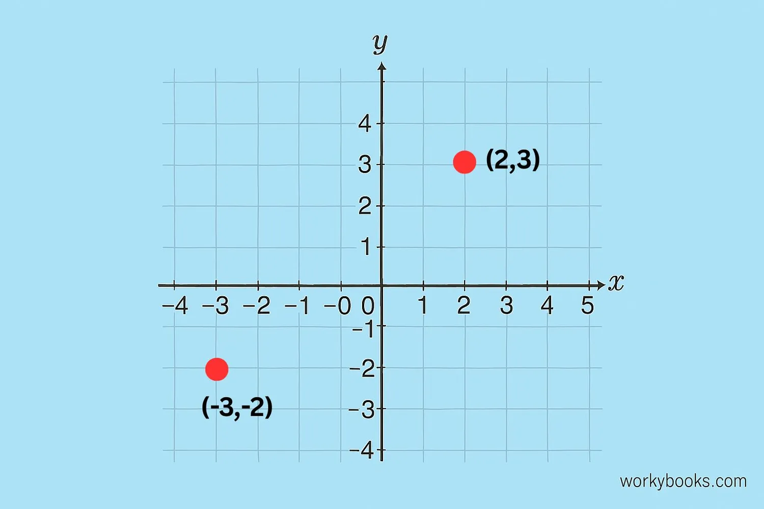
The Cartesian coordinate system is named after mathematician René Descartes. It uses two perpendicular number lines that cross at the origin (0,0):
- X-axis: The horizontal number line
- Y-axis: The vertical number line
Points are written as (x, y):
- The first number tells how far to move left/right from the origin
- The second number tells how far to move up/down
The grid is divided into four quadrants:
- Quadrant I: (+,+) - Top right
- Quadrant II: (-,+) - Top left
- Quadrant III: (-,-) - Bottom left
- Quadrant IV: (+,-) - Bottom right
Remember
When plotting points: "Run across, then climb up!" First move along the x-axis, then along the y-axis.
Polar Coordinate System
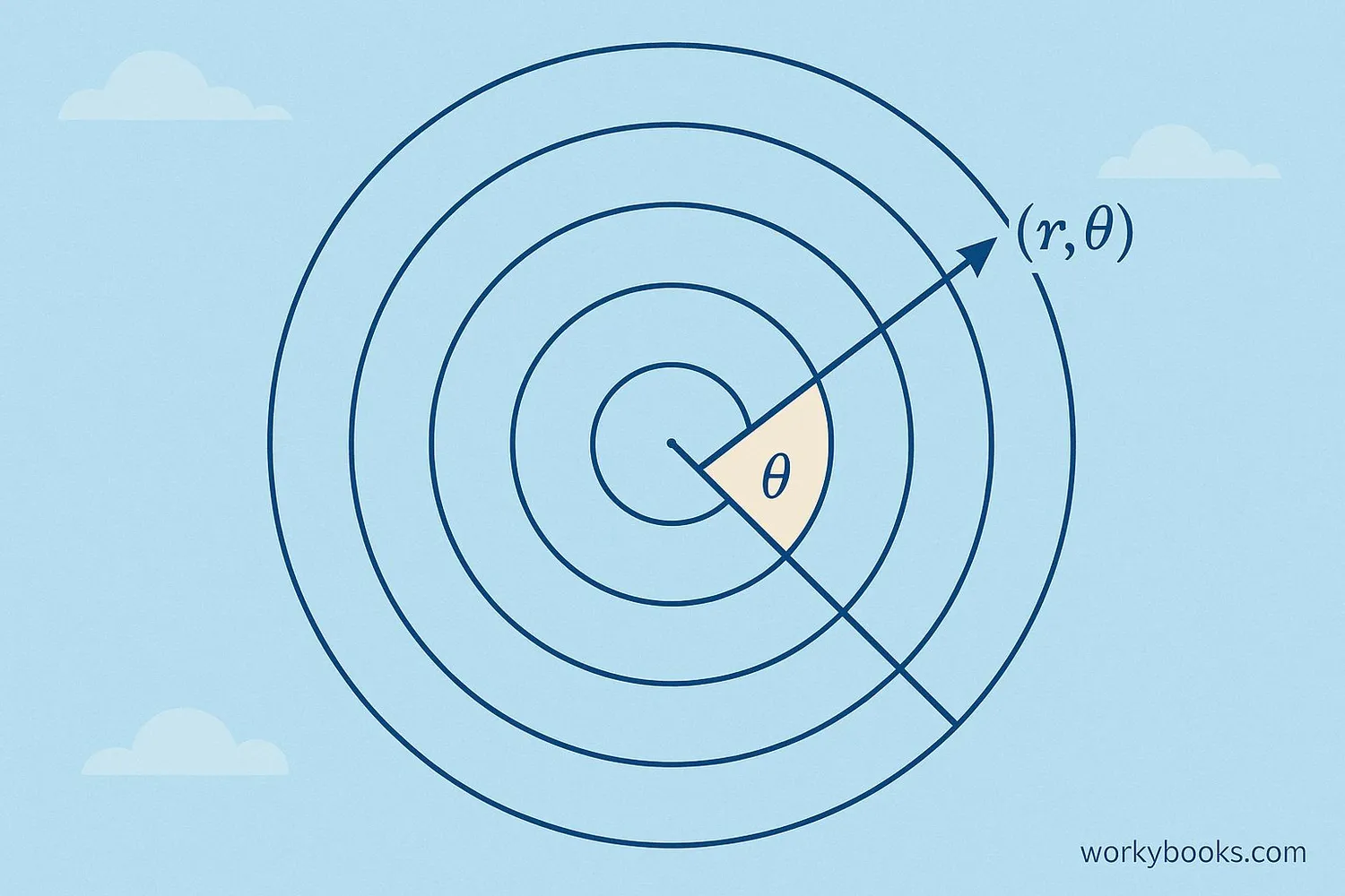
Polar coordinates are different from Cartesian coordinates. Instead of using horizontal and vertical distances, they use:
- Radius (r): How far from the center point
- Angle (θ): The direction from the center
Points are written as (r, θ):
- r is always positive and measures distance from the center
- θ is measured in degrees (0° to 360°) or radians
We use polar coordinates for:
- Circular motion (like planets orbiting the sun)
- Radar screens showing direction and distance
- Designing circular patterns
Conversion
We can convert between Cartesian and polar coordinates using trigonometry:
x = r × cos(θ)
y = r × sin(θ)
Geographic Coordinate System
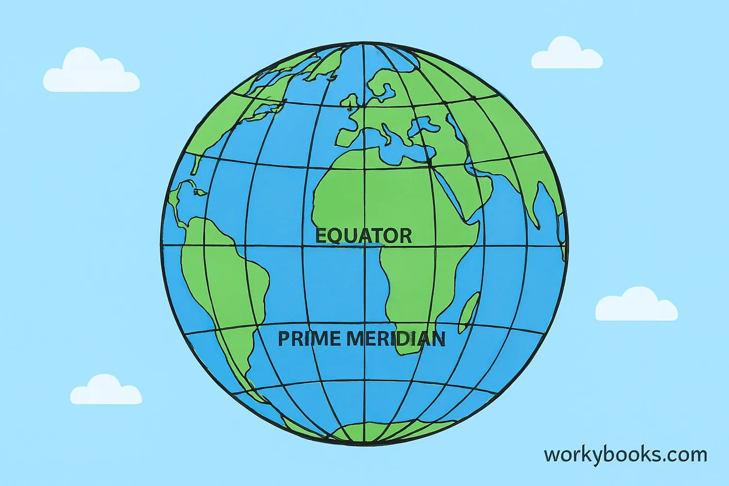
The geographic coordinate system helps us locate places on Earth using:
- Latitude: Measures north-south position (parallel to equator)
- Longitude: Measures east-west position (from prime meridian)
Key lines:
- Equator: 0° latitude, divides Earth into Northern and Southern Hemispheres
- Prime Meridian: 0° longitude, passes through Greenwich, England
Coordinates are written as (latitude, longitude):
- New York City: (40.7128° N, 74.0060° W)
- Sydney, Australia: (33.8688° S, 151.2093° E)
Remember
Latitude lines run east-west but measure north-south. Longitude lines run north-south but measure east-west!
Coordinate Examples
Let's see how coordinates are used in real life:
Example 1: Treasure Map
"Start at the old oak tree (origin). Walk 5 steps east (x=5), then 3 steps north (y=3). Dig here!"
These are Cartesian coordinates: (5, 3)
Example 2: Air Traffic Control
"Flight 123 is 200km from the airport at a bearing of 45°"
These are polar coordinates: (200, 45°)
Example 3: Finding a City
"Paris, France is located at 48.8566° N, 2.3522° E"
These are geographic coordinates
Practice: Plot these points on a Cartesian grid:
- A: (3, 4)
- B: (-2, 5)
- C: (0, -3)
Try This
Look at a map of your city. Can you find the coordinates of your school? What about your favorite park?
Coordinate System Quiz
Test your knowledge with this 5-question quiz. Choose the correct answer for each question.
Frequently Asked Questions
Here are answers to common questions about coordinate systems:
Math Trivia
Discover interesting facts about coordinate systems:
Descartes' Discovery
René Descartes invented the Cartesian coordinate system while watching a fly crawl on his ceiling. He realized he could describe its position using distances from two walls!
GPS Precision
The Global Positioning System (GPS) uses geographic coordinates and can pinpoint your location on Earth within 5 meters using satellites!
Space Coordinates
Astronomers use a special celestial coordinate system to locate stars and galaxies. It works like latitude and longitude but projected onto the sky!
Most Remote Place
Point Nemo in the Pacific Ocean (48°52.6'S, 123°23.6'W) is the Earth's farthest point from land. It's so remote that astronauts are often the closest humans!
