Geography of Ancient India
Interactive passage with audio narration, comprehension questions, and printable PDF.
By completing this purchase you agree to our Terms of Use and Privacy Policy. Your subscription renews automatically until you cancel. You can cancel anytime from your account settings. All sales are final and non-refundable. Digital content is available for download in your account immediately upon purchase.
What's included
Part of this bundle

Geography of Ancient India preview and details
About this printable Geography of Ancient India reading passage (Grades 5-8)
Sample passage and quiz from Geography of Ancient India
Reading passage and comprehension quiz preview
Geography of Ancient India
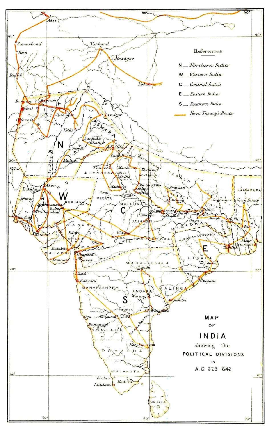
"The Ancient Geography of India - Map I" by Alexander Cunningham /
Source: Wikimedia Commons (Public domain).
The geography of Ancient India played a crucial role in shaping its early civilizations. Located in South Asia, Ancient India included the modern countries of India, Pakistan, and Bangladesh. The region's unique topography—including the towering Himalayas, the vast Indo-Gangetic Plain, and the dry Deccan Plateau—affected where people settled, how they farmed, and what kinds of societies they built.
One of the most important features of Ancient India was the Indus River system. Beginning in the Himalayas, the Indus and its tributaries created fertile land in an otherwise dry environment. Around 2600 BCE, people established large cities such as Harappa and Mohenjo-daro along these rivers. Archaeologists have uncovered evidence of advanced urban planning in these cities, including straight streets, drainage systems, and granaries for storing surplus grain. Clay seals and standardized weights found at these sites suggest a thriving trade network and organized government.
The monsoon climate was another defining aspect of Ancient India's geography. Each year, heavy seasonal rains flooded the rivers and deposited nutrient-rich silt onto the fields. This allowed farmers to grow wheat, barley, and later rice, supporting a large and complex society. However, the monsoon could be unpredictable; too little rain brought famine, while too much led to destructive floods. The people of Ancient India developed irrigation systems and built protective walls to cope with these challenges.
Geography also influenced Ancient India's connections with other cultures. The mountains to the north acted as a barrier, protecting the region from invasion but also limiting direct contact with Central Asia. However, passes such as the Khyber Pass allowed for some movement of people, ideas, and goods. Trade routes connected the Indus Valley to Mesopotamia, as shown by Mesopotamian records mentioning trade with "Meluhha," believed to be the Indus region. Artifacts from the Indus Valley have been found in ancient Sumerian cities, demonstrating early globalization.
The geography of Ancient India shaped not only its economic life but also its social structure. Villages and cities grew up along rivers, supporting specialists such as craftsmen, merchants, and priests. Social hierarchy developed, with evidence of different housing sizes and burial practices. Despite challenges from the environment, the people adapted and flourished for centuries. By about 1900 BCE, changes in river patterns and climate may have contributed to the decline of the Indus Valley Civilization, showing the close relationship between geography and history.
Understanding Ancient India's geography helps explain how and why civilizations rise and fall. It also highlights the ways people respond to their environment, a theme central to world history.
Interesting Fact: The city of Mohenjo-daro had public baths and brick-lined wells, some of the earliest examples of urban sanitation in the ancient world.
Comprehension quiz (8 questions)
1. Which river was key to Ancient India?
2. What made farming possible in Ancient India?
3. Which city is famous for public baths?
4. How did mountains affect Ancient India?
5. What was a challenge of the monsoon?
6. What evidence shows Indus trade with Mesopotamia?
7. The Indus cities had granaries for grain. True or false?
8. What does 'hierarchy' mean?
Perfect for the way you teach
- Build comprehension skills
- Auto-graded quiz
- Differentiated reading
- Read together at home
- Improve fluency
- Quiet reading time
- Reading curriculum support
- Independent practice
- Track Lexile growth