How Drones Help Scientists Study Earth
Interactive passage with audio narration, comprehension questions, and printable PDF.
By completing this purchase you agree to our Terms of Use and Privacy Policy. Your subscription renews automatically until you cancel. You can cancel anytime from your account settings. All sales are final and non-refundable. Digital content is available for download in your account immediately upon purchase.
What's included
How Drones Help Scientists Study Earth preview and details
About this printable How Drones Help Scientists Study Earth science reading passage, NGSS-aligned (Grades 6-8)
Sample passage and quiz from How Drones Help Scientists Study Earth
Reading passage and comprehension quiz preview
How Drones Help Scientists Study Earth
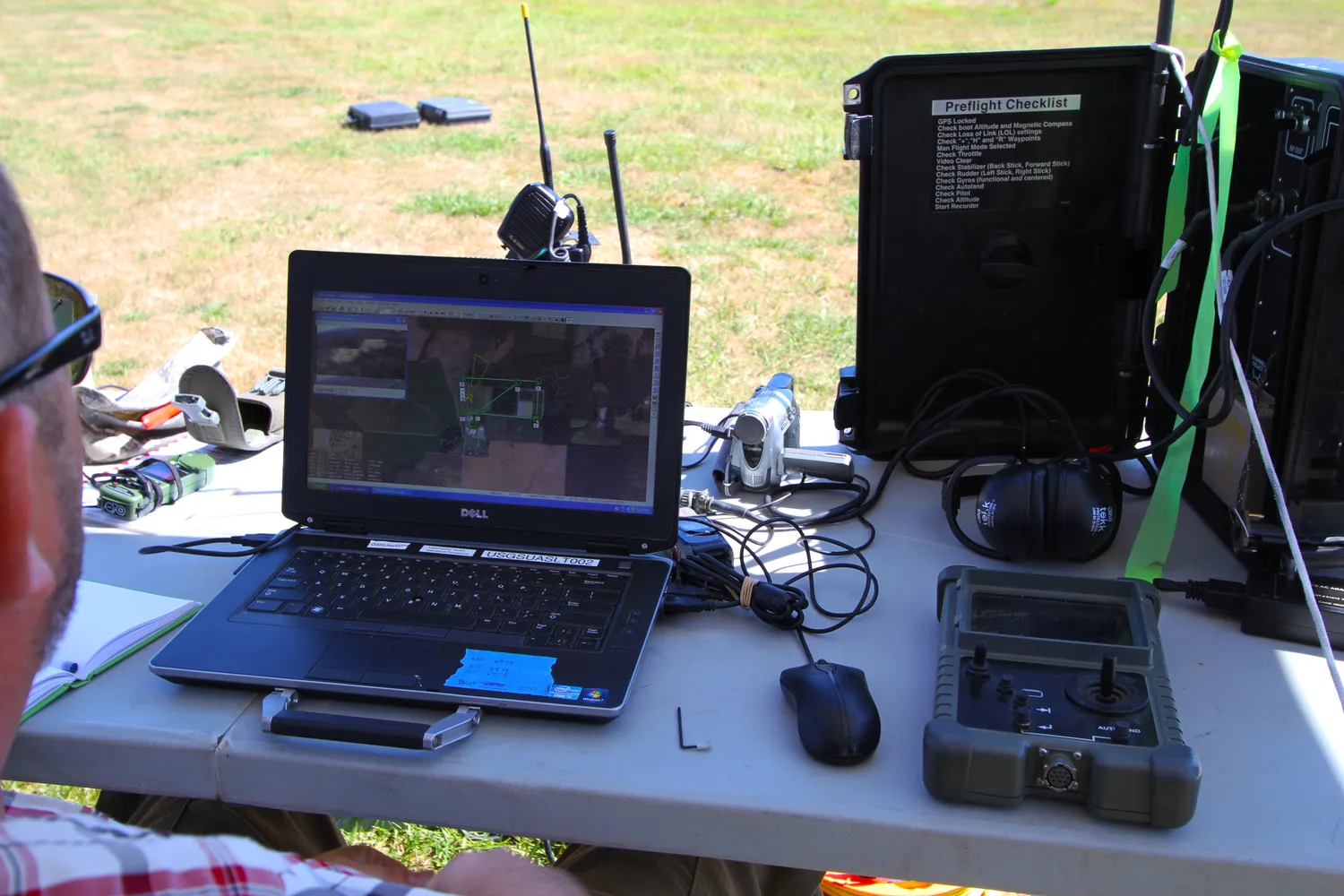
"USGS Team Flies Drones for Oregon BLM Forestry Research (14780984285)" by Bureau of Land Management Oregon and Washington from Portland, America / Wikimedia Commons
Drones are unmanned aircraft that scientists use to collect data about Earth's surface from above. These flying machines carry special equipment including cameras, sensors, and LiDAR technology. Scientists use drones to study places that are difficult or dangerous for humans to reach, such as melting glaciers, eroding coastlines, unstable landslides, dense forests, and disaster zones. Drone technology has changed how scientists gather information about our planet.
The equipment on drones collects different types of data. High-resolution cameras take detailed photographs from above, creating images that show changes in landscapes over time. Sensors measure temperature, moisture, air quality, and other environmental conditions. LiDAR, which stands for Light Detection and Ranging, uses laser beams to measure distances and create three-dimensional maps of the ground surface. When a drone flies over a forest, for example, LiDAR can measure tree height and density by sending out laser pulses and timing how long they take to bounce back. This technology can even see through gaps in tree branches to map the forest floor below.
Drones provide several advantages over traditional fieldwork methods. First, they collect data much faster than scientists working on foot. A drone can survey a glacier in hours, while the same work might take researchers weeks of hiking and climbing. Second, drones cost less than other methods like helicopter flights or satellite imaging. A research team can operate a drone for a fraction of the cost of renting an aircraft. Third, drones keep scientists safe by eliminating the need to enter hazardous areas. Instead of climbing onto an unstable landslide or walking across thin ice on a glacier, scientists can fly a drone over these dangerous locations.
Remote sensing with drones has proven especially valuable for studying changing environments. Scientists monitoring glaciers in Alaska use drones to measure ice thickness and track melting rates without risking falls into crevasses. Coastal researchers fly drones along shorelines to document erosion and measure how beaches change after storms. After natural disasters like earthquakes or hurricanes, emergency teams use drones to assess damage and locate people who need help, all without putting rescue workers in danger.
The data collected by drones helps scientists understand environmental changes and make predictions about the future. Forest researchers use drone images to count trees, identify diseased areas, and estimate how much carbon dioxide forests absorb from the atmosphere. This information helps predict how forests will respond to climate change. Scientists studying landslides use drone surveys to create detailed maps showing which hillsides are most likely to collapse during heavy rain. These predictions help communities prepare and stay safe.
Despite their advantages, drones have some limitations. Battery life restricts how long they can fly, usually between 20 and 40 minutes per flight. Weather conditions like strong winds or heavy rain can prevent safe drone operation. Drones also require skilled operators who understand both the technology and the science behind the research. However, as drone technology improves and becomes more affordable, more scientists are adding these tools to their research methods. Drones represent an important example of how engineering solutions can help solve scientific problems and expand our understanding of Earth's systems.
Interesting Fact: Some research drones can fly themselves using programmed flight paths and GPS coordinates, allowing scientists to repeat the exact same survey route multiple times to track changes over months or years.
Comprehension quiz (10 questions)
1. What equipment do drones carry to collect data about Earth's surface?
2. How does LiDAR technology work?
3. What does the term 'remote sensing' mean in the passage?
4. According to the passage, what is one advantage of using drones over traditional fieldwork?
5. Why do scientists in Alaska use drones to study glaciers?
6. What information do forest researchers collect using drone images?
7. Based on the passage, how do drones help after natural disasters?
8. What is one limitation of drone technology mentioned in the passage?
9. Drones are more expensive to operate than helicopter flights for research purposes.
10. Some research drones can fly themselves using programmed flight paths and GPS coordinates.
Perfect for the way you teach
- Build comprehension skills
- Auto-graded quiz
- Differentiated reading
- Read together at home
- Improve fluency
- Quiet reading time
- Reading curriculum support
- Independent practice
- Track Lexile growth