Premium
Indigenous Trail Networks
Interactive passage with audio narration, comprehension questions, and printable PDF.
Just this resource
$1.50
One-time purchase
Best value
Unlock everything
$49.99$29.99/yr
40% off until Aug 1 — 6,000+ resources
Unlock above to use these actions
- Format
- Interactive (Online), Printable (PDF)
- Grades
- 5678
- Subjects
- readinghistoryela
- Standards
- CA HSS 6.1RH.6-8.1RH.6-8.2WHST.6-8.2
- Languages
- English, Spanish
What's included
Reading passage
Reading comprehension
Audio narration
With word word highlighting
Comprehension quiz
Auto-graded
Writing activity
Open-ended response
Glossary & flashcards
Vocabulary practice
Differentiated version
Adapted for varied levels
Spanish translation
Bilingual support
About this reader
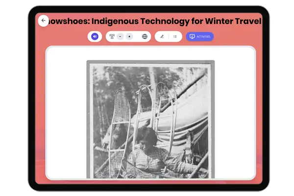
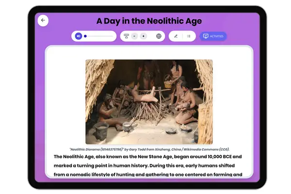
This passage explores the extensive Indigenous trail networks that connected the Americas before European contact, focusing on the Natchez Trace, the Great Trail, and the Inca road system. Students learn how these routes supported trade, communication, and cultural exchange across vast distances, using real historical examples and archaeological evidence. The passage highlights the engineering skills and social organization required to maintain such networks, comparing different regions and explaining their continued influence on modern infrastructure. Activities include a multiple-choice quiz, writing prompts focused on causation and significance, graphic organizers, and a timeline. This resource includes a Spanish translation, glossary, and read aloud audio, and aligns with CA HSS 6.1, RH.6-8.1, and literacy standards for world history.
Written by Workybooks TeamPublished by Workybooks
Preview
Sample passage and quiz content
Who it's for
Perfect for the way you teach
Teachers
- Build comprehension skills
- Auto-graded quiz
- Differentiated reading
Parents
- Read together at home
- Improve fluency
- Quiet reading time
Homeschoolers
- Reading curriculum support
- Independent practice
- Track Lexile growth
Topics
Indigenoustrail networksInca roadNatchez TracetradeAmericasworld historyGreat TrailinfrastructureNative American