This learning resource is available in interactive and printable formats. The interactive worksheet can be played online and assigned to students. The Printable PDF version can be downloaded and printed for completion by hand.
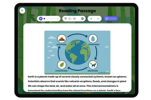
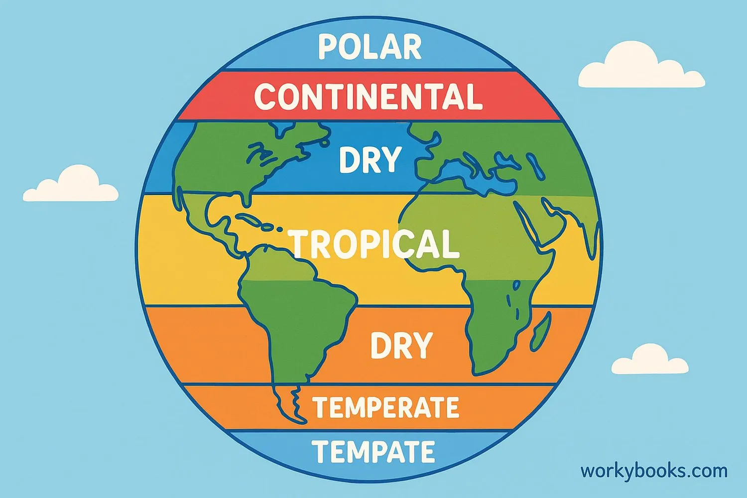
This passage provides an in-depth look at Earth’s climate zones using the Köppen classification system, covering tropical, dry, temperate, continental, and polar regions. Aligned to NGSS standard MS-ESS2-6, it explores how temperature and precipitation patterns distinguish each zone, their mechanisms, and their connections to global biomes and ecosystems. Students will examine how climate zones are identified, why they matter, and how scientific research and data support our understanding. The passage includes a glossary, differentiated text, Spanish translations, comprehension questions, writing prompts, and graphic organizers to support diverse learners. Audio integration is available for accessibility. This resource is ideal for grades 6-8 studying Earth science, climate, and environmental systems.
CONTENT PREVIEW
Expand content preview
Climate Zones
Climate zones are a fundamental way scientists organize Earth's surface based on long-term patterns of temperature and precipitation. Scientists use climate data collected over decades to classify regions into zones with similar weather conditions. These climate zones help explain why the world’s rainforests, deserts, grasslands, and ice caps are found where they are. The Köppen classification system is the most widely used system for grouping these zones, and it reveals important connections between climate, ecosystems, and human society.
How Climate Zones Are Classified The Köppen system is a scientific method for dividing the world into five major climate zones: tropical (A), dry (B), temperate (C), continental (D), and polar (E). Each zone is defined by its average temperature and precipitation patterns over many years. For example, the tropical zone has high temperatures all year and receives more than 150 centimeters of rainfall annually. The dry zone, in contrast, has very little precipitation, sometimes less than 25 centimeters each year. By analyzing data from weather stations and satellites, scientists can map where each climate zone exists and track how they change over time. This classification helps scientists and governments make decisions about agriculture, water use, and disaster planning.
Characteristics and Examples of Each Zone Each climate zone supports different types of biomes—large regions with specific types of plants and animals. The tropical zone includes rainforests like the Amazon, where temperatures rarely drop below 18°C and rainfall is abundant. The dry zone includes deserts such as the Sahara, with extreme temperatures and sparse vegetation. Temperate zones, like much of Western Europe and the eastern United States, experience moderate temperatures and seasonal changes, supporting forests and grasslands. The continental zone, found in places like central Asia and Canada, has greater temperature differences between summer and winter and supports forests and prairies. The polar zone, which includes Antarctica and the Arctic, has very cold temperatures, little precipitation, and unique life forms adapted to the cold. These zones interact with Earth's atmosphere and ocean currents, influencing weather and long-term climate change.
Climate Zones and Biomes: Global Connections The relationship between climate zones and biomes is a key concept in Earth science. The specific combination of temperature and precipitation in a zone determines what plants and animals can survive there. For example, tropical rainforests occur only in regions with both high temperatures and abundant rainfall. Deserts are found in dry zones where evaporation exceeds precipitation. Changes in climate zones—such as those caused by global warming—can shift the boundaries of biomes, affecting biodiversity and human livelihoods. Scientists use climate models and long-term data to predict how climate zones and biomes will respond to environmental changes.
Understanding climate zones helps us respond to environmental challenges, from designing sustainable cities to protecting endangered species. The study of climate zones also connects to broader scientific ideas about systems, change, and human impact on Earth.
Interesting Fact: The polar zone receives less direct sunlight than any other zone, which is why temperatures can drop below -50°C in winter!
Which system is most widely used to classify Earth's climate zones?