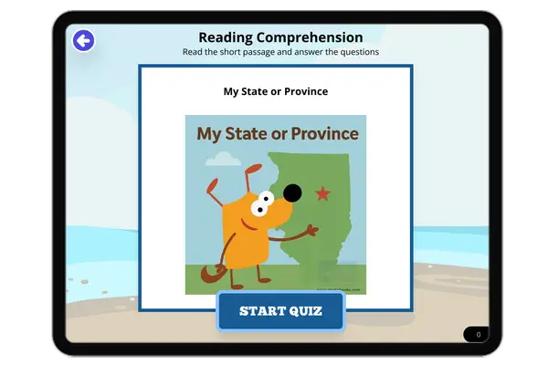
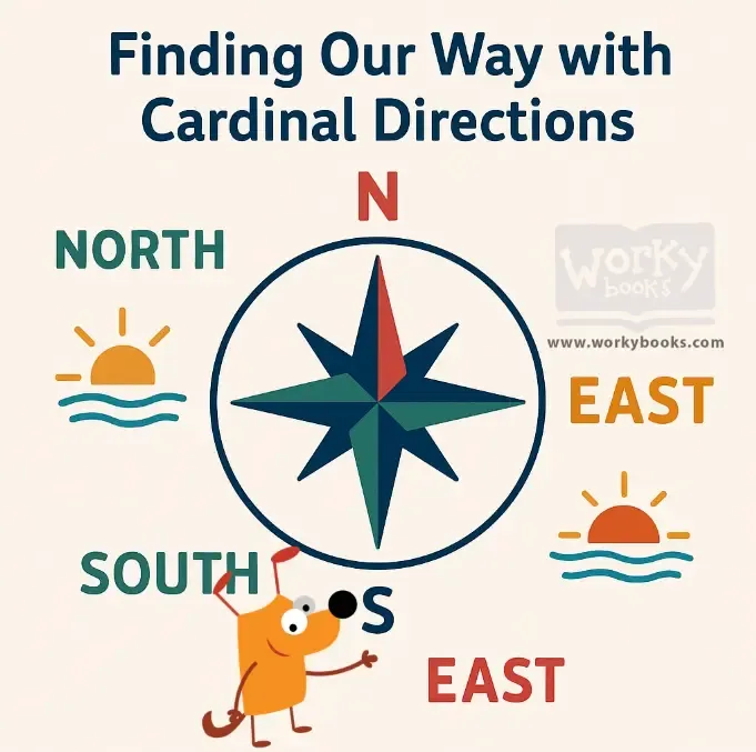
Finding Our Way with Cardinal Directions — Reading Comprehension
Rate this
Premium Resource
Present
Present in classroom. No work saved
Assign
Classroom with student accounts, Track progress
Quick Play
No student accounts, assign with a link
Grades
3
4
5
6
7
Standards
FL.SS.2.G.1.1
SS.2.G.1.3
PRINT+DIGITAL RESOURCE
This learning resource is available in interactive and printable formats. The interactive worksheet can be played online and assigned to students. The Printable PDF version can be downloaded and printed for completion by hand.
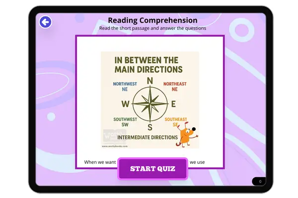
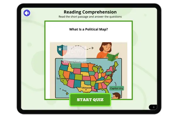
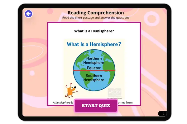
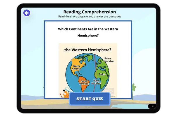
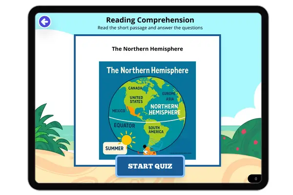
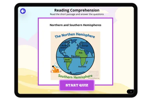
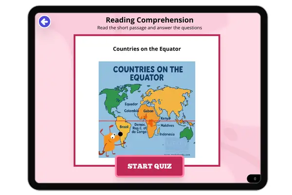
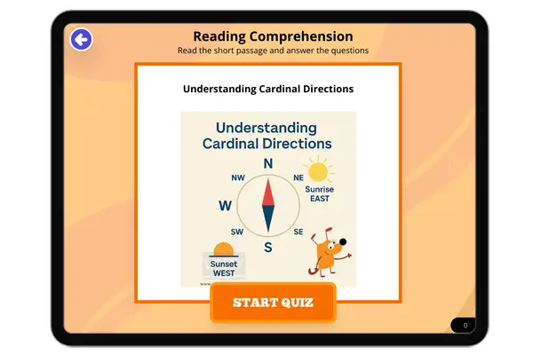
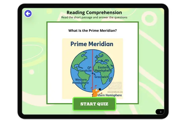
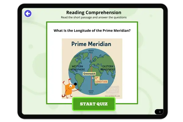
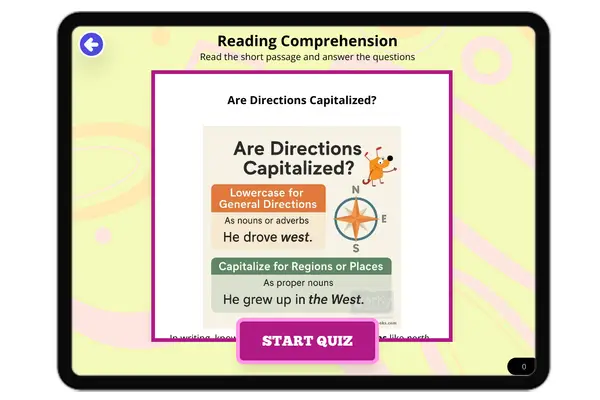
This engaging passage introduces elementary students to the concept of cardinal directions—north, south, east, and west. Aligned with standard SS.2.G.1.1, the passage explains how these main directions help us find places and move around using maps and compasses. Students learn how natural clues, like the rising and setting sun, also show direction. Real-life examples such as GPS and how people use compasses highlight the topic’s importance. This reading helps young learners build strong geography and map-reading skills while connecting the concept to the real world. The content supports reading comprehension and includes vocabulary and critical thinking activities to reinforce learning.
CONTENT PREVIEW
Expand content preview
Cardinal Directions: North, South, East, and West
We use four special directions to describe where things are on Earth. These are called cardinal directions: north, south, east, and west. People everywhere use these directions, just like the four corners of a playground. When you know where north is, you can figure out where everything else is!
What Do the Directions Mean?
North points toward the North Pole and the North Star. South is the opposite direction, leading toward the South Pole. East is where the sun rises each morning. West is where the sun sets every evening. These directions work the same way no matter where you are on Earth.
Why Do We Need Directions?
Cardinal directions help us describe where places are, give directions, and read maps. They help us navigate so we don’t get lost. Weather reports use them to tell us which way storms are moving. For example, Canada is north of the United States, and the Pacific Ocean is west of California. These directions are a universal language for location.
How Do We Find Directions?
We can use tools and clues from nature to find our way. A compass has a magnetic needle that always points north. The sun rises in the east and sets in the west. At noon, the sun is highest in the south (in the Northern Hemisphere). At night, the North Star shows us where north is. Today, GPS uses satellites to tell us our exact direction.
Memory Tricks and the Compass Rose
To remember the order of the directions, try a trick like “Never Eat Soggy Waffles” (clockwise: North, East, South, West). A compass rose is a symbol on maps that shows all four cardinal directions. The top usually points to north.
Explorers and Directions
Long ago, explorers used cardinal directions to sail across oceans and make maps of new places. Knowing directions was the key to discovering the world!
Interesting Fact: The word “cardinal” comes from the Latin word for “important.”
Which direction does a compass needle point?
NorthSouthEastWest
Where does the sun rise?
EastWestNorthSouth
What is the opposite of north?
EastSouthWestCompass
Why do we use cardinal directions?
Describe locationsOnly for weatherOnly for explorersOnly on playgrounds
How do explorers use directions?
To find new placesTo cook foodTo plant treesTo make clothes
What tool uses a magnetic needle?
CompassMapGPSStar
The sun sets in the east. True or False?
TrueFalse
What is a compass rose?
Map symbol for directionsA type of flowerA kind of stormA weather report
Perfect For:
👩🏫 Teachers
• Reading comprehension practice
• Auto-graded assessments
• Literacy skill development
👨👩👧👦 Parents
• Reading practice at home
• Comprehension improvement
• Educational reading time
🏠 Homeschoolers
• Reading curriculum support
• Independent reading practice
• Progress monitoring
Reading Features:
📖
Reading Passage
Engaging fiction or nonfiction text
❓
Comprehension Quiz
Auto-graded questions
📊
Instant Feedback
Immediate results and scoring
📄
Printable Version
Download for offline reading
🔊
Read Aloud
Voice-over with word highlighting
Reviews & Ratings
No reviews yet. Be the first to share your experience!
Related Content
What Is a Hemisphere?
This passage introduces elementary students to the concept of a *hemisphere*, explaining how Earth can be divided into h...
FL.SS.2.G.1.1SS.2.G.1.1
What Is a Topographic Map?
This passage introduces elementary students to the *topographic map*, a special kind of map that shows *elevation* and *...
FL.SS.2.G.1.1SS.2.G.1.2
In Between the Main Directions
This short passage teaches students about intermediate directions—northeast, southeast, southwest, and northwest—which f...
FL.SS.2.G.1.1SS.2.G.1.3
What Is a Physical Map?
This passage introduces young students to physical maps and explains how they show Earth's natural features such as moun...
FL.SS.2.G.1.1SS.2.G.1.2
What Is a Population Map?
This passage teaches students about population maps, a kind of thematic map that shows how many people live in different...
FL.SS.2.G.1.1SS.2.G.1.3
What Is a Political Map?
This passage introduces elementary students to political maps, which show how land is divided into countries, states, an...
FL.SS.2.G.1.1SS.2.G.1.3
The Western Hemisphere
This reading passage introduces students to the *Western Hemisphere*, the half of the Earth located west of the *Prime M...
FL.SS.2.G.1.1SS.2.G.1.2
Which Continents Are in the Western Hemisphere?
This passage teaches elementary students which continents are found in the *Western Hemisphere*, including North America...
FL.SS.2.G.1.1SS.2.G.1.3
The Northern Hemisphere
This passage introduces elementary students to the *Northern Hemisphere*, the half of Earth that lies above the *Equator...
FL.SS.2.G.1.1SS.2.G.1.2
Northern and Southern Hemispheres
This passage explains the difference between the *Northern Hemisphere* and the *Southern Hemisphere*, the two halves of ...
FL.SS.2.G.1.1SS.2.G.1.3
Where Is the Equator?
This passage teaches students about the *Equator*, the imaginary line that divides Earth into the *Northern* and *Southe...
FL.SS.2.G.1.1SS.2.G.1.2
Countries on the Equator
This passage introduces students to countries located on the *Equator*, including Ecuador, Brazil, Kenya, and Indonesia....
FL.SS.2.G.1.1SS.2.G.1.3
Understanding Cardinal Directions
This engaging passage explains the concept of cardinal directions—north, south, east, and west—and their importance in n...
FL.SS.2.G.1.1SS.2.G.1.1
What Is the Prime Meridian?
This passage explains the *Prime Meridian*, the imaginary line that runs from the *North Pole* to the *South Pole* and d...
FL.SS.2.G.1.1SS.2.G.1.3
What Is the Longitude of the Prime Meridian?
This passage explains that the *Prime Meridian* is the line of *0 degrees longitude* that divides the Earth into the *Ea...
FL.SS.2.G.1.1SS.2.G.1.3
Are Directions Capitalized?
This passage teaches students about capitalization rules for direction words such as north, south, east, and west. It ex...
FL.SS.2.G.1.1SS.2.G.1.1
My Room and My House
This passage introduces young learners to the idea of personal space by starting with the room and expanding to the hous...
FL.SS.2.G.1.1SS.2.G.1.3
My Street and My Neighborhood
This reading passage helps students understand the concepts of a street and a neighborhood. It highlights how neighborho...
FL.SS.2.G.1.1SS.2.G.1.3
My Town or City
In this passage, students learn how their towns and cities are structured. It explains the role of neighborhoods, commun...