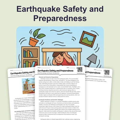
Tsunami Warning and Safety — Reading Comprehension
Rate this
Premium Resource
Present
Present in classroom. No work saved
Assign
Classroom with student accounts, Track progress
Quick Play
No student accounts, assign with a link
Grades
5
6
7
8
Standards
MS-ESS3-2
PRINT+DIGITAL RESOURCE
This learning resource is available in interactive and printable formats. The interactive worksheet can be played online and assigned to students. The Printable PDF version can be downloaded and printed for completion by hand.
This comprehensive middle school science passage examines the systems and science behind tsunami warning and safety. Aligned with NGSS standard MS-ESS3-2, it covers how tsunami warnings work, the differences between a watch, advisory, and warning, and natural warning signs like earthquakes and ocean recession. The passage explains evacuation procedures, including quantitative guidance on elevation and distance, and discusses vertical evacuation in certain situations. It highlights the importance of inundation maps, building codes, and community drills such as TsunamiReady. Real-world applications, scientific thinking, and cause-and-effect relationships are emphasized. Glossary terms are embedded, and the passage includes a Spanish translation, differentiated version, comprehension quiz, writing prompts, and two graphic organizers. This resource is ideal for classroom use and supports audio integration for diverse learners.
CONTENT PREVIEW
Expand content preview
Tsunami Safety Guide
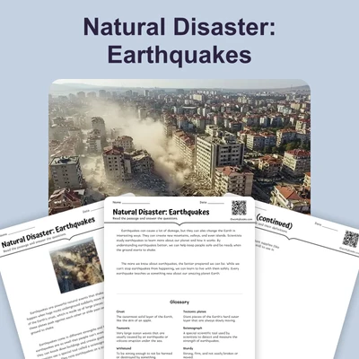
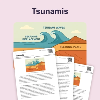
Tsunamis are powerful ocean waves caused by sudden movements of the sea floor, often triggered by large underwater earthquakes. These waves can travel at speeds of up to 500 miles per hour across the open ocean and bring devastating flooding when they reach coastal areas. Understanding tsunami warning systems and proper safety actions is critical for communities located near the ocean. The ability to recognize both official and natural warnings can save lives during these rare but dangerous events.
How Tsunami Warnings Work
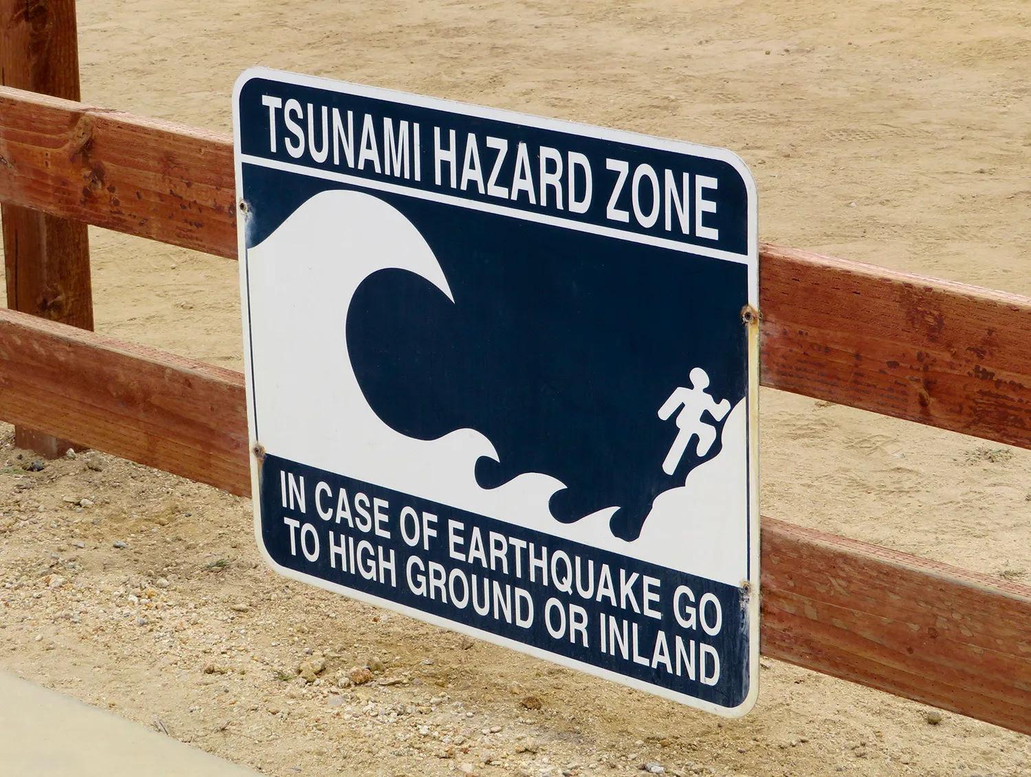
Modern tsunami warning systems use a combination of seismic sensors, ocean buoys, and computer models to detect and predict tsunamis. When an underwater earthquake occurs, seismic stations quickly measure its strength and location. If the earthquake is strong enough and near the ocean, scientists analyze whether it could generate a tsunami. Based on this information, agencies issue three main types of tsunami alerts: a Watch (a tsunami is possible, threat being evaluated), an Advisory (a minor tsunami is expected, stay out of water and away from beaches), and a Warning (a significant tsunami is expected, evacuate immediately). In addition to technological alerts, people should watch for natural warning signs such as a strong earthquake, sudden ocean recession, or a loud roaring sound. These natural signs often occur before any official warning is issued, especially for local tsunamis, where waves can arrive within minutes.
Evacuation and Preparedness
Once a warning is issued, quick action is essential. The most critical step is evacuation—moving inland or to higher ground. Experts recommend reaching at least 100 feet (30 meters) above sea level or moving at least 2 miles (3 kilometers) inland, but local guidance should always be followed. In some places, inundation maps show which areas are likely to be flooded in a tsunami, helping people plan safe routes. Sometimes, there may not be enough time for horizontal evacuation. In these situations, vertical evacuation to the upper floors of sturdy, reinforced concrete buildings can provide lifesaving protection. It is important to remember that tsunamis often arrive in multiple waves over several hours, so people should not return until authorities give the all-clear signal. Regular education and drills, such as the TsunamiReady program, train residents to respond quickly and safely.
Building Codes and Community Safety
Communities in tsunami-prone regions use building codes and land planning to reduce risks. Structures are sometimes built on elevated platforms or with special foundations to withstand water forces. In addition, emergency planners use computer models to simulate possible tsunami scenarios and refine evacuation plans. Scientific research on past tsunamis provides valuable data about how waves travel and impact different coastlines. These findings help improve warning systems and community preparedness. Through a combination of technology, community action, and scientific research, societies can better protect people from the dangers of tsunamis.
Understanding tsunami warning and safety is an example of how different systems—natural, technological, and social—work together to reduce disaster risks. These efforts demonstrate the importance of scientific thinking and preparedness in protecting lives and property during natural events.
Interesting Fact: The 2011 Japan tsunami traveled across the entire Pacific Ocean, reaching the coasts of North and South America within hours and causing measurable effects over 5,000 miles away.
What causes most tsunamis?
Sudden movements of the sea floor from underwater earthquakesHeavy rainfall and floodingStrong winds and stormsVolcanic eruptions far from the ocean
What is the main purpose of a tsunami warning system?
To detect and predict tsunamis so people can stay safeTo measure the temperature of the oceanTo prevent earthquakes from happeningTo warn ships about storms
What should people do if they receive a tsunami warning?
Evacuate to higher ground or inland immediatelyGo to the beach to watch the wavesWait until the ocean looks dangerousStay in place and do nothing
What does a 'Watch' mean in tsunami warnings?
A tsunami is possible and the threat is being evaluatedA major tsunami is about to strikeIt is safe to return to the beachA minor tsunami is expected, stay out of the water
What is one natural warning sign of a possible tsunami?
Why is it important not to return to flooded areas until officials say it is safe?
Multiple tsunami waves may arrive over several hoursThere may be free food availableThe ocean water is warmAnimals may have returned
True or False: TsunamiReady is a program that helps prepare communities for tsunamis.
TrueFalse
True or False: Inundation maps show the safest place to go surfing during a tsunami.
TrueFalse
Which of the following is a reason for strong building codes in tsunami areas?
To help buildings withstand water forces during tsunamisTo keep buildings warm in winterTo make buildings taller for better viewsTo prevent forest fires
Perfect For:
👩🏫 Teachers
• Reading comprehension practice
• Auto-graded assessments
• Literacy skill development
👨👩👧👦 Parents
• Reading practice at home
• Comprehension improvement
• Educational reading time
🏠 Homeschoolers
• Reading curriculum support
• Independent reading practice
• Progress monitoring
Reading Features:
📖
Reading Passage
Engaging fiction or nonfiction text
❓
Comprehension Quiz
Auto-graded questions
📊
Instant Feedback
Immediate results and scoring
📄
Printable Version
Download for offline reading
🔊
Read Aloud
Voice-over with word highlighting
Reviews & Ratings
No reviews yet. Be the first to share your experience!
Related Content
Natural Disaster: Earthquake
Earthquakes occur when tectonic plates move, causing the ground to shake. Understanding earthquakes helps us prepare and...
RI.3.1RI.4.4RI.4.2RI.5.2
Volcanic Eruptions: Causes, Types, and Key Features
This science passage explains volcanic eruptions, aligned with NGSS MS-ESS3-2 (natural hazards) and ESS2-2 (Earth’s syst...
MS-ESS3-2MS-ESS2-2RST.6-8.3
Kīlauea Volcano: Hawaii’s Ever-Changing Landscape
This passage details Kīlauea's volcanic history and status, aligned with NGSS MS-ESS3-2 (natural hazards) and ESS2-3 (Ea...
MS-ESS3-2MS-ESS2-3RST.6-8.2
All About Seismometers
This informational science passage explores seismometers and their role in measuring earthquakes, designed specifically ...
MS-ESS3-2MS-ESS2-3RST.6-8.2
What Is the Difference Between Magma and Lava?
This educational reading passage explains the critical difference between magma and molten rock beneath Earth's surface ...
MS-ESS2-3MS-ESS3-2RST.6-8.4
Obsidian: The Natural Glass Rock
This science reading passage explores obsidian, a volcanic glass that forms when lava cools so rapidly that crystals can...
MS-ESS2-3MS-ESS3-2RST.6-8.4
Measuring Hurricane Intensity – The Saffir-Simpson Hurricane Wind Scale
This NGSS-aligned science reading passage explains how the Saffir-Simpson Hurricane Wind Scale is used to measure the in...
MS-ESS3-2
Tools and Technology in Earth Science
This middle school science reading passage explores the wide range of tools and technologies used in Earth science, from...
MS-ESS2-2MS-ESS3-2MS-ETS1-1MS-PS4-3
Types of Maps
This engaging science passage for grades 6-8 introduces students to the various types of maps and their uses, supporting...
MS-ESS2-2MS-ESS3-2MS-ETS1-1MS-ETS1-4
Mass Movements
This NGSS-aligned passage introduces middle school students to the science of mass movements—gravity-driven motions of r...
MS-ESS2-1MS-ESS3-2
What Causes Earthquakes?
This middle school science passage explains what causes earthquakes, focusing on the interactions between tectonic plate...
MS-ESS2-2MS-ESS3-2
Floods: Causes and Types
This middle school science passage provides a comprehensive look at floods, their causes, types, and impacts, addressing...
MS-ESS3-2
Hurricanes and Tropical Cyclones
This in-depth passage for grades 6-8 covers hurricanes and tropical cyclones, aligning with NGSS standards MS-ESS3-2 and...
MS-ESS3-2MS-ESS2-5
Hurricane Preparedness and Safety
This passage explores the science and practical strategies of hurricane preparedness and safety, designed for middle sch...
MS-ESS3-2MS-ETS1-1
Tornadoes
This informational science passage for grades 6-8 explores the science of tornadoes, aligning with NGSS standards MS-ESS...
MS-ESS3-2MS-ESS2-5
Tsunamis
This middle school science passage explores tsunamis, focusing on their causes, characteristics, and impacts. Students w...
MS-ESS3-2
Earthquake Hazards and Damage
This middle school science reading passage examines the hazards and damage caused by earthquakes, aligned with NGSS MS-E...
MS-ESS3-2
Earthquake Zones and Patterns
This informational science passage introduces middle school students to the global distribution of earthquakes, focusing...
MS-ESS2-2MS-ESS3-2
Seismic Waves
This comprehensive middle school passage introduces students to seismic waves, the energy released during earthquakes. A...