Earthquake Zones and Patterns
Interactive passage with audio narration, comprehension questions, and printable PDF.
What's included
Earthquake Zones and Patterns preview and details
About this printable Earthquake Zones and Patterns science reading passage, NGSS-aligned (Grades 5-8)
Sample passage and quiz from Earthquake Zones and Patterns
Reading passage and comprehension quiz preview
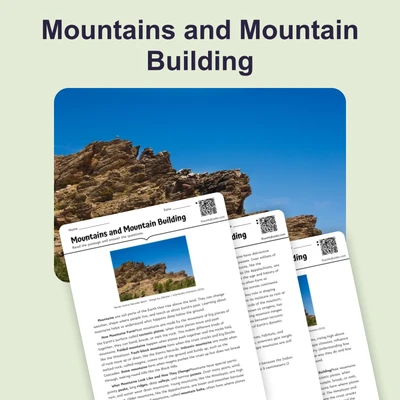
Earthquake Zones and Patterns
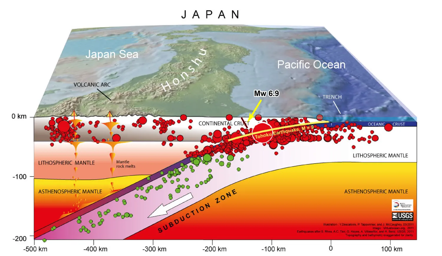
"Block Diagram showcasing earthquake hypocenter" by USGS / Wikimedia Commons (Public domain).
Earthquakes are powerful natural events that can shake the ground and cause major changes to landscapes and human structures. These events do not happen randomly across Earth's surface. Instead, most earthquakes occur in specific zones that follow the boundaries of tectonic plates. Understanding where and why earthquakes happen helps scientists predict risk and protect people.
Global Distribution of Earthquakes
Scientists have mapped earthquake locations around the world for over a century. They found that about 80-90% of all earthquakes occur along a zone called the Pacific Ring of Fire. This ring stretches around the Pacific Ocean and marks places where oceanic plates are sinking beneath continental plates in a process called subduction. Subduction causes intense pressure and, when released, results in frequent and sometimes very strong earthquakes. Another important zone is the Mid-ocean Ridge system, where plates move apart at divergent boundaries, leading to smaller, shallow earthquakes. A third major zone is the Mediterranean-Himalayan belt, created by the collision of plates at convergent boundaries. This belt includes regions like the Himalayas, where the Indian plate pushes into the Eurasian plate, causing powerful earthquakes.
Relationship to Plate Boundaries
Earthquake patterns reveal the boundaries of Earth's tectonic plates. Most earthquakes are found where plates interact. At convergent boundaries, plates collide and one plate is forced beneath another, producing deep and sometimes very large earthquakes. At transform boundaries, plates slide past each other, creating shallow but sometimes destructive quakes, like those along California's San Andreas Fault. Mapping earthquakes also shows intraplate earthquakes, which occur within a plate, away from boundaries. These are less common, but can still be damaging, as seen in the New Madrid earthquakes in Missouri.
Seismic Risk and Real-World Applications
Knowing where earthquakes are most likely to happen helps communities prepare. Scientists use seismic zones to identify areas at high risk. Countries like Japan, Chile, and Indonesia have strict building codes to reduce earthquake damage because they lie in active seismic zones. Earthquake patterns also provide evidence for the theory of plate tectonics, showing that Earth's crust is dynamic and constantly changing. By studying global earthquake distribution, scientists can better predict hazards, protect lives, and understand Earth's internal processes.
Understanding earthquake zones connects to broader scientific ideas about Earth's systems. It shows how energy and matter move within our planet and affect human societies. Ongoing research into earthquake patterns helps improve early warning systems and disaster planning.
Interesting Fact: The deepest recorded earthquake occurred at a depth of about 700 kilometers (435 miles) beneath the Earth's surface, far below where most quakes happen!
Comprehension quiz (10 questions)
1. What is the Pacific Ring of Fire?
2. Where do the majority of earthquakes occur?
3. Which process causes earthquakes at the Pacific Ring of Fire?
4. What are intraplate earthquakes?
5. What does 'convergent boundary' mean in the passage?
6. What is a seismic zone?
7. Why do countries like Japan have strict building codes?
8. What does mapping earthquake locations help scientists do?
9. True or False: Most earthquakes happen randomly all over the Earth's surface.
10. True or False: The deepest earthquakes can happen as deep as 700 kilometers below Earth's surface.
Perfect for the way you teach
- Build comprehension skills
- Auto-graded quiz
- Differentiated reading
- Read together at home
- Improve fluency
- Quiet reading time
- Reading curriculum support
- Independent practice
- Track Lexile growth