What Are Landforms
Interactive passage with audio narration, comprehension questions, and printable PDF.
What's included
What Are Landforms preview and details
About this printable What Are Landforms science reading passage, NGSS-aligned (Grades 6-8)
Sample passage and quiz from What Are Landforms
Reading passage and comprehension quiz preview
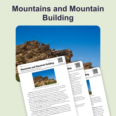
What Are Landforms
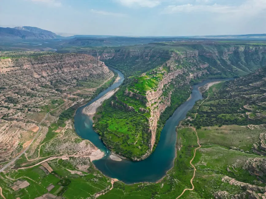
Scientists classify landforms into four major types: mountains, plateaus, plains, and valleys. Aerial view of the lush green Sulak Valley with meandering river in Şırnak, Türkiye." by Mehmet Karaca / Pexels.
Earth's surface is covered with different shapes and features called landforms. A landform is a natural feature of Earth's solid surface that has a characteristic shape. Scientists classify landforms into four major types: mountains, plateaus, plains, and valleys. Each type has distinct characteristics that help us identify it.
Mountains are landforms that rise high above the surrounding land with steep sides and a peak or ridge at the top. They typically rise at least 1,000 feet above their base. Mountains form through several geological processes. The most common process involves tectonic plates, which are massive slabs of Earth's crust that slowly move. When two tectonic plates collide, they push rock upward, creating mountain ranges like the Himalayas. Volcanic activity can also build mountains when molten rock erupts and hardens over time. The Rocky Mountains in North America formed from tectonic plate collisions millions of years ago.
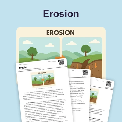
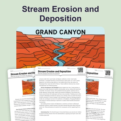
Plateaus are elevated flatlands that rise sharply above the surrounding area. Unlike mountains, plateaus have flat or gently rolling tops. They form when tectonic forces lift large areas of rock upward without folding or tilting them significantly. Erosion, the process of wearing away rock and soil by wind and water, can also create plateaus by removing softer rock layers and leaving harder rock behind. The Colorado Plateau in the southwestern United States contains the Grand Canyon, carved by millions of years of erosion.
Plains are broad, flat or gently rolling areas of land with low elevation. They are the most common landform on Earth. Plains form in several ways. Coastal plains develop when ocean levels drop, exposing the seafloor. River plains form when rivers deposit sediment over thousands of years. The Great Plains of central North America stretch from Canada to Texas and were shaped by ancient seas and rivers depositing layers of sediment.
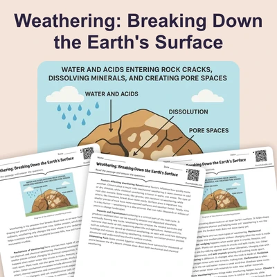
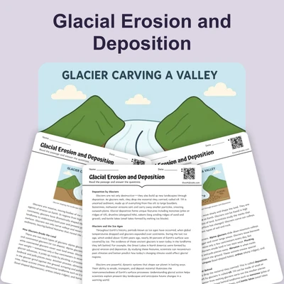
Valleys are low areas of land between hills or mountains. They typically have a V-shape or U-shape depending on how they formed. Rivers carve V-shaped valleys through erosion as water cuts through rock over millions of years. Glaciers, which are massive sheets of moving ice, carve U-shaped valleys by scraping and pushing rock as they advance. The process of weathering, which breaks down rock through physical and chemical changes, works alongside erosion to shape valleys.
All landforms change continuously through geological processes. Tectonic plate movements build new mountains while erosion wears them down. Rivers deposit sediment in some areas while carving valleys in others. These processes operate on timescales of millions of years, making changes difficult to observe directly. Scientists study landforms to understand Earth's history and predict future changes. By examining rock layers and landform shapes, they can determine what forces created specific features and when those events occurred.
Interesting Fact: Mount Everest, the world's tallest mountain, grows about 4 millimeters taller each year because the tectonic plates beneath it continue to collide and push the mountain upward.
Comprehension quiz (10 questions)
1. What is a landform?
2. How tall must a mountain typically be above its base?
3. What is the main difference between mountains and plateaus?
4. According to the passage, erosion is the process of:
5. What does the term 'sediment' mean in the context of the passage?
6. Which landform is created when glaciers scrape and push rock as they advance?
7. Why do landform changes happen slowly and are difficult to observe directly?
8. What can scientists learn by examining rock layers and landform shapes?
9. Plains are the most common landform on Earth.
10. Mount Everest is getting shorter each year due to erosion.
Perfect for the way you teach
- Build comprehension skills
- Auto-graded quiz
- Differentiated reading
- Read together at home
- Improve fluency
- Quiet reading time
- Reading curriculum support
- Independent practice
- Track Lexile growth