Premium
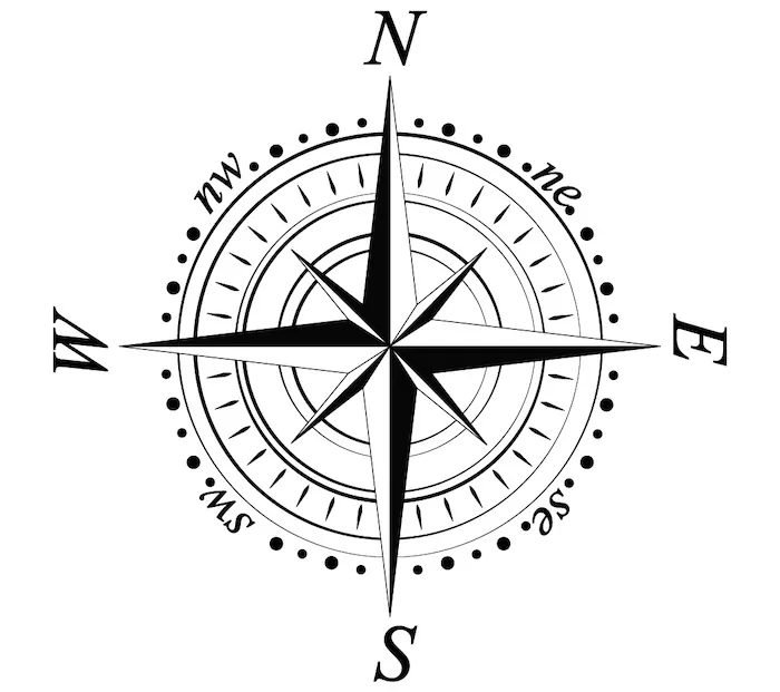
Compass Rose
Interactive passage with audio narration, comprehension questions, and printable PDF.
Just this resource
$1.50
One-time purchase
Best value
Unlock everything
$49.99$29.99/yr
40% off until Aug 1 — 6,000+ resources
Unlock above to use these actions
- Format
- Interactive (Online), Printable (PDF)
- Grades
- 345
- Subjects
- scienceela
- Standards
- NGSS 4-ESS2-2
- Languages
- English, Spanish
What's included
Reading passage
Reading comprehension
Audio narration
With word word highlighting
Comprehension quiz
Auto-graded
Writing activity
Open-ended response
Glossary & flashcards
Vocabulary practice
Differentiated version
Adapted for varied levels
Spanish translation
Bilingual support
About this reader
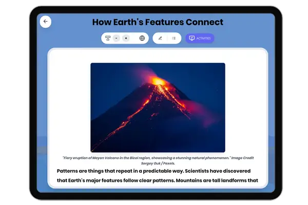
This engaging 350-word science passage introduces Grade 4-5 students to the compass rose, a fundamental map-reading tool. Aligned with NGSS standard 4-ESS2-2, the passage explains how the compass rose displays the four cardinal directions—north, south, east, and west—and helps us navigate using maps. Students learn how to use directional language to describe locations and give directions, connecting abstract map concepts to real-world applications like finding their way to school or describing their neighborhood. The passage includes audio integration for enhanced accessibility, making it perfect for diverse learners. Through concrete analogies and familiar examples, students discover how the compass rose serves as a universal guide for understanding spatial relationships. The content features bolded key vocabulary terms with immediate definitions, multiple-choice comprehension questions, writing activities, and graphic organizers that reinforce understanding of directional concepts and map reading skills essential for scientific observation and geographic literacy.
Written by Workybooks TeamPublished by Workybooks
Preview
Sample passage and quiz content
Who it's for
Perfect for the way you teach
Teachers
- Build comprehension skills
- Auto-graded quiz
- Differentiated reading
Parents
- Read together at home
- Improve fluency
- Quiet reading time
Homeschoolers
- Reading curriculum support
- Independent practice
- Track Lexile growth
Topics
compass rosemap directionsnorthsoutheastwestcardinal directionsnavigationmap readingNGSS 4-ESS2-2