Plains and Plateaus
Interactive passage with audio narration, comprehension questions, and printable PDF.
What's included
Plains and Plateaus preview and details
About this printable Plains and Plateaus science reading passage, NGSS-aligned (Grades 3-5)
Sample passage and quiz from Plains and Plateaus
Reading passage and comprehension quiz preview
Plains and Plateaus
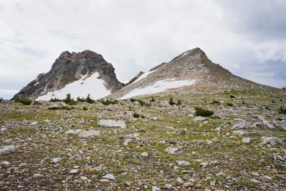
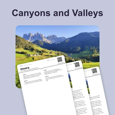
"Stunning view of rocky mountains with patches of snow under a cloudy sky." Image Credit Robert Schrader / Pexels.
A plain is a large, flat area of land. Plains stretch for many miles without big hills or mountains. They are often found in the middle of continents, far from oceans and mountain ranges. Plains are important because they provide excellent land for farming. The flat ground makes it easy for farmers to plant and harvest crops. The soil on plains is usually rich in nutrients, which helps plants grow strong and healthy.
The Great Plains in the center of the United States is a famous example of a plain. This region produces wheat, corn, and other crops that feed millions of people. Because plains are so flat and wide, you can see them clearly on maps as large areas without many changes in elevation, or height above sea level.
A plateau is different from a plain. A plateau is also a flat area of land, but it sits high above the surrounding land. Think of a plateau like a table—it has a flat top but steep sides that drop down to lower ground. Plateaus form when forces inside Earth push land upward or when water and wind wear away softer rock around harder rock. Both plains and plateaus are common landforms, which are natural features of Earth's surface. You can identify these landforms on maps by looking for flat areas at different heights.
Interesting Fact: The Colorado Plateau in the southwestern United States is so large that it covers parts of four states: Colorado, Utah, Arizona, and New Mexico!
Comprehension quiz (8 questions)
1. What is a plain?
2. Where are plains often found?
3. Why are plains good for farming?
4. How is a plateau like a table?
5. What can you see on maps?
6. How do plateaus form?
7. Plains and plateaus are both flat on top.
8. What does elevation mean?
Perfect for the way you teach
- Build comprehension skills
- Auto-graded quiz
- Differentiated reading
- Read together at home
- Improve fluency
- Quiet reading time
- Reading curriculum support
- Independent practice
- Track Lexile growth