Rivers and Water Features
Interactive passage with audio narration, comprehension questions, and printable PDF.
What's included
Rivers and Water Features preview and details
About this printable Rivers and Water Features science reading passage, NGSS-aligned (Grades 3-5)
Sample passage and quiz from Rivers and Water Features
Reading passage and comprehension quiz preview
Rivers and Water Features
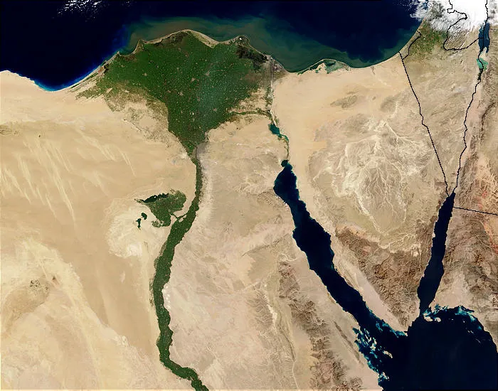
"Nile River and delta from orbit" by Jacques Descloitres, MODIS Rapid Response Team, NASA/sh / Wikimedia Commons.
A river is a body of moving water that flows across the land. Rivers always flow from higher ground to lower ground because of gravity. This movement is important because rivers carry water from mountains and hills all the way to lakes or the ocean.
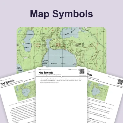
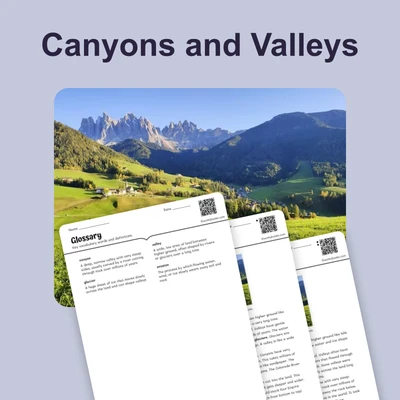
As rivers flow, they shape the land in different ways. Moving water has enough power to carve valleys, which are low areas between hills or mountains. Rivers also carry tiny pieces of rock and soil called sediment. When a river reaches the ocean or a lake, it slows down and drops the sediment it has been carrying. Over time, this sediment builds up to form a delta, which is new land shaped like a triangle or fan at the river's mouth.
A lake is a body of water that collects in a low area of land. Unlike rivers, lakes do not flow in one direction. Coastlines are the places where land meets the ocean. When you look at a map, you can trace a river's path from the mountains where it starts to the ocean where it ends. You can also see patterns in where water features are located on Earth's surface.
Interesting Fact: The longest river in the world is the Nile River in Africa, which flows for about 4,130 miles—that's like driving from New York to California and back!
Comprehension quiz (8 questions)
1. Where do rivers always flow?
2. What are tiny pieces of rock called?
3. What shape is a delta?
4. Why do rivers carve valleys?
5. What happens when a river slows down?
6. How can maps help us understand rivers?
7. Lakes flow in one direction like rivers.
8. What is a coastline?
Perfect for the way you teach
- Build comprehension skills
- Auto-graded quiz
- Differentiated reading
- Read together at home
- Improve fluency
- Quiet reading time
- Reading curriculum support
- Independent practice
- Track Lexile growth