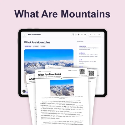
How to Read Data from Maps — Reading Comprehension
Rate this
Premium Resource
Present
Present in classroom. No work saved
Assign
Classroom with student accounts, Track progress
Quick Play
No student accounts, assign with a link
Grades
3
4
5
Standards
NGSS 4-ESS2-2
PRINT+DIGITAL RESOURCE
This learning resource is available in interactive and printable formats. The interactive worksheet can be played online and assigned to students. The Printable PDF version can be downloaded and printed for completion by hand.
This 250-word reading passage introduces fourth-grade students to the essential skill of reading data from maps, aligned with NGSS standard 4-ESS2-2 and the Disciplinary Core Idea ESS2.B: Plate Tectonics and Large-Scale System Interactions. Students learn that maps contain valuable data and information that can be analyzed to find patterns and answer scientific questions about Earth's features. The passage explains how to use a map legend to identify features, how to observe patterns in geographic data, and how to draw conclusions from map information. Real-world examples include identifying mountain ranges, tracking river flow patterns, and locating earthquake zones. The content is presented in accessible, grade-appropriate language with bolded vocabulary terms defined in context. Students practice the core skill of analyzing and interpreting data from maps through hands-on activities including multiple-choice comprehension questions, writing prompts that require application of concepts, and graphic organizers for organizing map observations. The passage is audio-integrated for accessibility and includes a Spanish translation to support English language learners. All activities reinforce the fundamental understanding that maps are scientific tools for displaying and analyzing Earth science data.
CONTENT PREVIEW
Expand content preview
Learning to identify Earth’s features and patterns using a map legend.
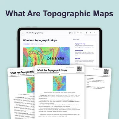
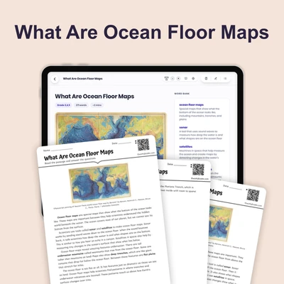
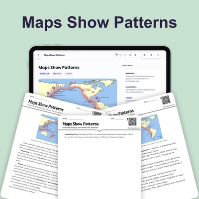
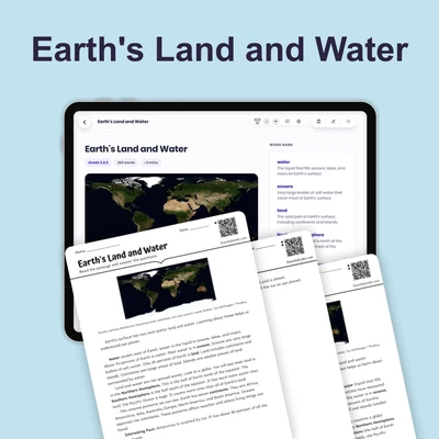
A map is a drawing that shows information about a place on Earth. Maps contain data — facts and information that can be collected and studied. When scientists read data from maps, they look carefully at what the map shows and use that information to find patterns and answer questions.
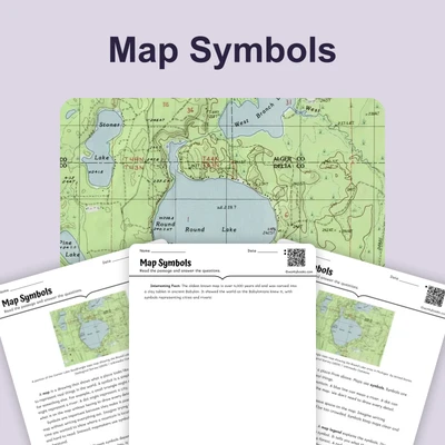
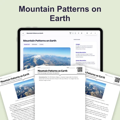
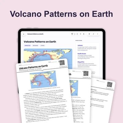
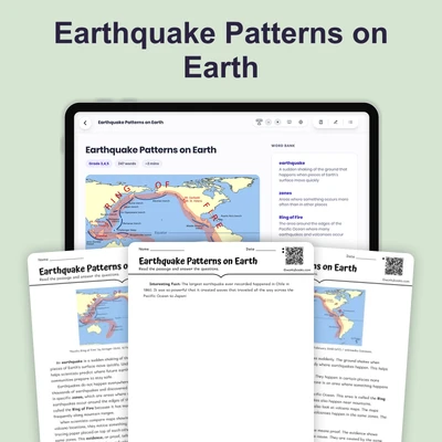
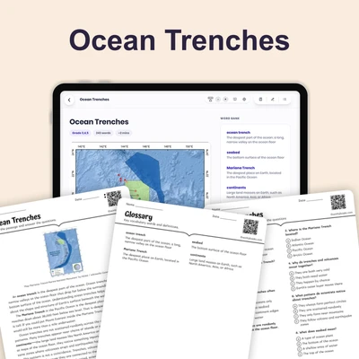
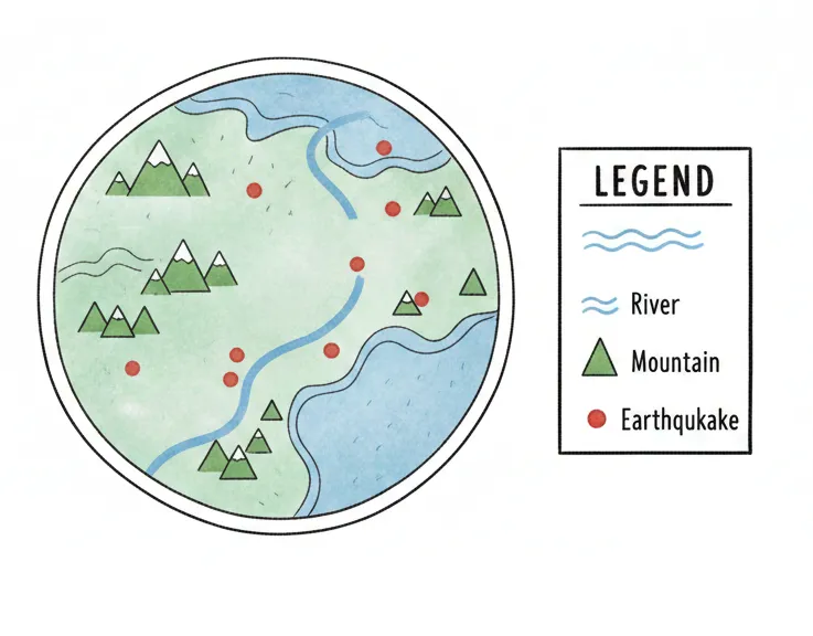
Every map has a legend, which is like a key that explains what the symbols and colors mean. For example, a legend might show that blue lines represent rivers, triangles represent mountains, or red dots show where earthquakes happened. By using the legend, you can identify different features — important parts of Earth's surface shown on the map.
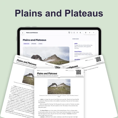
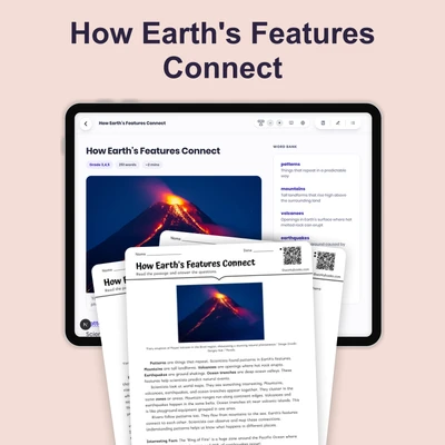
Reading data from a map means asking questions and looking for patterns. Where are the tallest mountains located? Do rivers flow toward the ocean or away from it? Are earthquakes clustered in certain areas, or are they spread out evenly? Scientists use maps to study Earth's surface and understand how different features are connected.
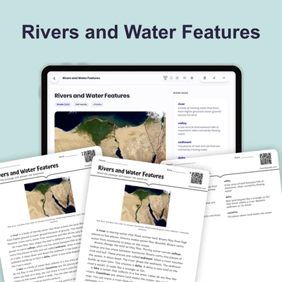
When you analyze a map, you make observations — you notice what you see. Then you draw conclusions — you figure out what the data means. This skill helps scientists understand patterns in nature, like why certain areas have more volcanoes or where water flows across the land.
Interesting Fact: The oldest known map was created over 4,000 years ago in ancient Babylon and was carved on a clay tablet!
What is a map?
A drawing showing information about EarthA tool for measuring distanceA picture of the skyA book about geography
What does a legend do?
Shows the size of the mapExplains what symbols and colors meanLists all the citiesTells stories about the place
What might blue lines represent on a map?
MountainsEarthquakesRiversCities
Why do scientists use maps?
To draw pretty picturesTo study Earth and find patternsTo write storiesTo measure temperature
What pattern might you find on a map?
Where earthquakes are clusteredWhat people eat for lunchHow clouds moveWhen the sun sets
What do you do after making observations?
Stop looking at the mapDraw conclusions about the dataColor the mapThrow the map away
Maps contain data that can be studied.
TrueFalse
What does the word 'features' mean?
Colors on a mapImportant parts of Earth's surfaceLines on a gridNames of countries
Perfect For:
👩🏫 Teachers
• Reading comprehension practice
• Auto-graded assessments
• Literacy skill development
👨👩👧👦 Parents
• Reading practice at home
• Comprehension improvement
• Educational reading time
🏠 Homeschoolers
• Reading curriculum support
• Independent reading practice
• Progress monitoring
Reading Features:
📖
Reading Passage
Engaging fiction or nonfiction text
❓
Comprehension Quiz
Auto-graded questions
📊
Instant Feedback
Immediate results and scoring
📄
Printable Version
Download for offline reading
🔊
Read Aloud
Voice-over with word highlighting
Reviews & Ratings
No reviews yet. Be the first to share your experience!
Related Content
Map Symbols
This engaging 350-word science passage introduces Grade 4-5 students to the concept of map symbols and their importance ...
NGSS 4-ESS2-2
Compass Rose
This engaging 350-word science passage introduces Grade 4-5 students to the compass rose, a fundamental map-reading tool...
NGSS 4-ESS2-2
What Are Maps
This engaging 350-word science passage introduces Grade 4-5 students to the concept of maps as flat drawings that repres...
NGSS 4-ESS2-2
Canyons and Valleys
This engaging 350-word science passage helps Grade 4-5 students understand how canyons and valleys form through the proc...
NGSS 4-ESS2-2
What Are Topographic Maps
This engaging 250-word reading passage introduces fourth-grade students to topographic maps and how they represent Earth...
NGSS 4-ESS2-2
What Are Ocean Floor Maps
This Grade 4 science reading passage introduces students to ocean floor maps and how scientists create them using sonar ...
NGSS 4-ESS2-2
Maps Show Patterns
This engaging 250-word reading passage introduces fourth-grade students to the concept of identifying patterns on maps a...
NGSS 4-ESS2-2ESS2.B
Earth's Land and Water
This 250-word reading passage introduces fourth-grade students to the fundamental concept of how land and water are dist...
NGSS 4-ESS2-2ESS2.B
What Are Mountains
This 250-word reading passage introduces fourth-grade students to mountains as one of Earth's most dramatic landforms. A...
NGSS 4-ESS2-2ESS2.B
Mountain Patterns on Earth
This 250-word reading passage introduces fourth-grade students to mountain patterns on Earth, aligned with NGSS standard...
NGSS 4-ESS2-2
Plains and Plateaus
This Grade 4 science reading passage explores plains and plateaus, two common landforms found across Earth's surface. Al...
NGSS 4-ESS2-2
Rivers and Water Features
This 250-word reading passage introduces fourth-grade students to rivers and water features as outlined in NGSS 4-ESS2-2...
NGSS 4-ESS2-2ESS2.B
Volcano Patterns on Earth
This Grade 4 science reading passage introduces students to volcano patterns on Earth, aligned with NGSS standard 4-ESS2...
NGSS 4-ESS2-2
Earthquake Patterns on Earth
This engaging 250-word reading passage introduces fourth-grade students to earthquake patterns on Earth, aligned with NG...
NGSS 4-ESS2-2
Ocean Trenches
This engaging 250-word reading passage introduces fourth-grade students to ocean trenches, the deepest parts of Earth's ...
NGSS 4-ESS2-2
How Earth's Features Connect
This engaging 250-word reading passage introduces fourth-grade students to the fascinating patterns connecting Earth's m...