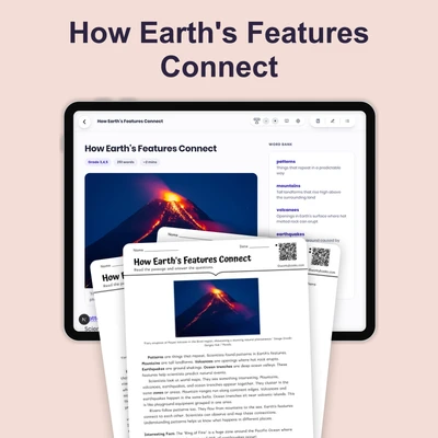
Maps Show Patterns
Interactive passage with audio narration, comprehension questions, and printable PDF.
What's included
Maps Show Patterns preview and details
About this printable Maps Show Patterns science reading passage, NGSS-aligned (Grades 3-5)
Sample passage and quiz from Maps Show Patterns
Reading passage and comprehension quiz preview
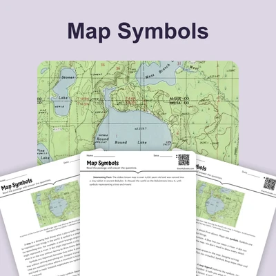
Maps Show Patterns
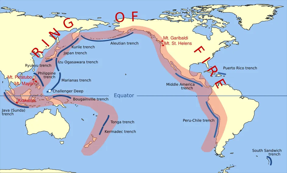
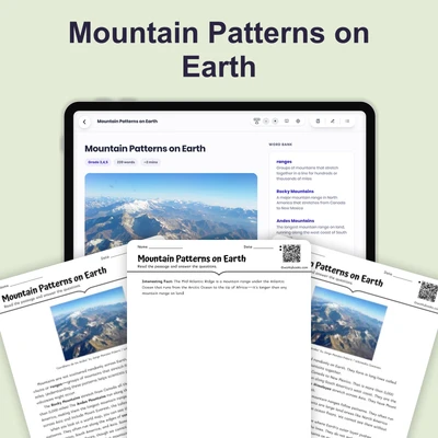
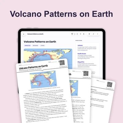
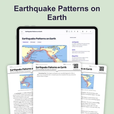
"Pacific Ring of Fire" by Gringer 23:52, 10 February 2009 (UTC) / Wikimedia Commons.
When scientists study maps, they look for patterns — features that repeat or appear in groups in certain areas. A pattern is something that happens over and over in a predictable way. Maps help scientists see these patterns clearly.
Mountains are tall landforms that rise high above the surrounding land. On maps, mountains often form in long chains, which are groups of mountains connected in a line. The Rocky Mountains in North America and the Andes Mountains in South America are examples of mountain chains. These chains stretch for thousands of miles.
Rivers are large streams of flowing water. Rivers always flow from high ground to low ground, usually ending in an ocean or lake. If you look at a map, you can trace a river from the mountains where it starts down to the sea where it ends. This pattern happens because water flows downhill, just like a ball rolling down a playground slide.
Scientists also notice that volcanoes and earthquakes tend to happen in the same zones, or areas. A volcano is a mountain that can erupt with hot melted rock. An earthquake is when the ground shakes. These events cluster together on maps, often near mountain chains or ocean edges.
These patterns are not random. They give scientists important clues about how Earth works beneath its surface.
Interesting Fact: The "Ring of Fire" is a zone around the Pacific Ocean where 75% of the world's volcanoes are located and where 90% of earthquakes happen!
Comprehension quiz (8 questions)
1. What is a pattern?
2. How do mountains often appear on maps?
3. Where do rivers always flow?
4. Why do scientists study map patterns?
5. Where do volcanoes and earthquakes cluster?
6. What makes water flow downhill in rivers?
7. Patterns on maps are completely random.
8. What is a chain in geography?
Perfect for the way you teach
- Build comprehension skills
- Auto-graded quiz
- Differentiated reading
- Read together at home
- Improve fluency
- Quiet reading time
- Reading curriculum support
- Independent practice
- Track Lexile growth