Reading PassagePremium

Flood Hazard Mitigation

Interactive passage with audio narration, comprehension questions, and printable PDF.

No ratings yet
Grades 5–8ScienceElaEnglish · SpanishInteractive · Printable
Aligned toMS-ESS3-2MS-ETS1-1
Just this resource
$1.50
One-time purchase
Best value
Unlock everything
$49.99$29.99/yr
40% off until Aug 1 — 10,000+ resources
Renews at $49.99/year.
Unlock above to use these actions

What's included

Reading passage
Audio narration
Comprehension quiz
Writing activity
Glossary & flashcards
Differentiated version
Spanish translation

Flood Hazard Mitigation preview and details

About this printable Flood Hazard Mitigation science reading passage, NGSS-aligned (Grades 5-8)

This NGSS-aligned science passage for grades 6-8 explores flood hazard mitigation, focusing on how communities can reduce flood risk using engineering, planning, and nature-based solutions. Students will learn about structural measures like levees, floodwalls, dams, and reservoirs, as well as non-structural approaches such as floodplain zoning, building codes, and early warning systems. The passage explains the importance of forecasting, personal safety, and the environmental impacts of different methods. The text integrates real-world applications and scientific thinking, showing the complexity and interactions of human and natural systems. Activities include a multiple-choice quiz, writing prompts, and graphic organizers to deepen understanding. This resource supports MS-ESS3-2 and MS-ETS1-1 standards and is audio integrated for accessibility. Keywords: flood hazard mitigation, engineering, levees, wetlands, NGSS, safety.
Written by Workybooks TeamPublished by Workybooks
Preview

Sample passage and quiz from Flood Hazard Mitigation

Reading passage and comprehension quiz preview

Flood Hazard Mitigation
Flood Hazard Mitigation
Flood response and Mitigation in Climate Change  

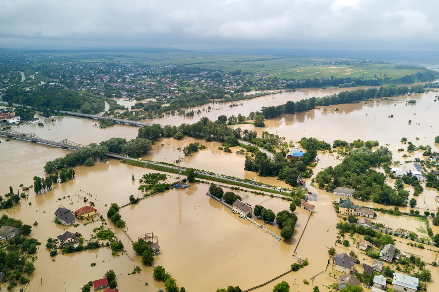
Floods are among the most damaging natural hazards, causing billions of dollars in losses and threatening lives every year. Communities located near rivers or coasts often face high flood risk due to heavy rainfall, rapid snowmelt, or storms. Reducing flood risk, known as flood hazard mitigation, is a major challenge for engineers, city planners, and scientists. The main goal is to protect people, property, and the environment using a mix of solutions.

Structural Measures: Building Barriers and Managing Water

Engineers design structural measures to control or contain floodwaters. Levees and floodwalls are built along rivers to keep water from spilling into neighborhoods. Dams and reservoirs store excess water during storms, releasing it slowly to prevent downstream flooding. Sometimes, river channels are modified—widened, deepened, or straightened—to move water away faster, a process called channel modification. Flood control basins temporarily hold floodwaters and help reduce the impact on urban areas. While these structures can be effective, they have limitations. If a levee breaks, the resulting flood may be even worse. These measures can also harm ecosystems or give residents a false sense of security, leading to more development in risky zones.

Non-Structural and Nature-Based Solutions

Not all flood solutions involve construction. Non-structural measures include rules and planning to reduce risk. For example, floodplain zoning restricts building in areas most likely to flood. Building codes may require homes to be elevated or floodproofed. Insurance programs, such as the National Flood Insurance Program (NFIP), help people recover after floods. Early warning systems and emergency response plans save lives by giving people time to evacuate. Recently, nature-based solutions have gained popularity. Restoring wetlands absorbs floodwaters, while reforestation slows rain runoff by increasing vegetation. Allowing rivers more space to overflow, known as river restoration, can reduce pressure on artificial barriers. Green infrastructure—like parks, rain gardens, and permeable pavement—lets water soak into the ground rather than run off into streets.

Flood Forecasting, Monitoring, and Personal Safety

Accurate flood forecasting uses rainfall monitoring, stream gauges, and computer models to predict where and when floods might occur. This information guides emergency actions and helps communities plan evacuations. Personal safety is also critical: Never drive through flooded roads, as just 15 centimeters of moving water can sweep away a car. Having evacuation plans and staying informed through alerts can save lives. Although no single method prevents all floods, combining engineering, planning, and nature-based solutions creates resilient communities that can adapt to changing risks.

Flood hazard mitigation demonstrates the importance of systems thinking in science—understanding how human actions, technology, and natural processes interact. As climate change increases flood risks in many regions, ongoing research and innovation are needed to protect people and ecosystems.

Interesting Fact: 
Wetlands can absorb up to 60% of incoming floodwaters, acting like natural sponges during heavy rains.

Comprehension quiz (10 questions)

1. What is the main goal of flood hazard mitigation?

To protect people, property, and the environment from floods.
To build as many dams as possible.
To stop all rainfall.
To create more rivers.

2. Which of the following is a structural measure for flood control?

Levee
Flood insurance
Floodplain zoning
Early warning system

3. What is one limitation of using levees and floodwalls?

They can create a false sense of security.
They always prevent floods completely.
They help wetlands grow.
They make it rain less.

4. What does 'floodplain zoning' mean in the passage?

Limiting building in areas that are likely to flood.
Building more houses near rivers.
Making parks in cities.
Digging channels in the floodplain.

5. What is a reservoir?

A storage area for water, usually created by a dam.
A type of levee.
A warning system for floods.
A natural wetland.

6. Why are nature-based solutions like wetlands important for flood mitigation?

They absorb floodwaters and reduce flood impact.
They increase water runoff.
They make floods happen faster.
They replace all structural measures.

7. Based on the passage, which statement is most accurate?

Combining different methods is the best way to reduce flood risk.
Building more dams is the only solution.
Floods cannot be predicted at all.
Nature-based solutions are never used.

8. If a community only relies on levees for flood protection, what might happen?

A levee failure could cause a worse flood than expected.
Flood risk is completely eliminated.
Wetlands will grow faster.
Rainfall will decrease.

9. True or False: Flood forecasting uses rainfall data and computer models to help predict floods.

True
False

10. True or False: You should always drive through flooded roads if you are in a hurry.

True
False
Who it's for

Perfect for the way you teach

Teachers
  • Build comprehension skills
  • Auto-graded quiz
  • Differentiated reading
Parents
  • Read together at home
  • Improve fluency
  • Quiet reading time
Homeschoolers
  • Reading curriculum support
  • Independent practice
  • Track Lexile growth
Topics

Reviews & Ratings

No reviews yet. Be the first to share your experience!

More reading you might love

20 more
Passage
Natural Disaster: Earthquake - reading educational content
Grades 4–5

Natural Disaster: Earthquake

weather and climate · RI.3.1

Free
Passage
Obsidian: The Natural Glass Rock - reading educational content
Grades 5–8

Obsidian: The Natural Glass Rock

science · MS-ESS2-3

Free
Passage
All About Seismometers - reading educational content
Grades 5–8

All About Seismometers

science · MS-ESS3-2

Free
Passage
What Is the Difference Between Magma and Lava? - reading educational content
Grades 5–8

What Is the Difference Between Magma and Lava?

science · MS-ESS2-3

$1.50
Passage
Tools and Technology in Earth Science - reading educational content
Grades 5–8

Tools and Technology in Earth Science

science · MS-ESS2-2

$1.50
Passage
Types of Maps  - reading educational content
Grades 5–8

Types of Maps

earth science · MS-ESS2-2

$1.50
Passage
Mass Movements - reading educational content
Grades 5–8

Mass Movements

science · MS-ESS2-1

$1.50
Passage
What Causes Earthquakes? - reading educational content
Grades 5–8

What Causes Earthquakes?

science · MS-ESS2-2

$1.50
Passage
Floods: Causes and Types - reading educational content
Grades 5–8

Floods: Causes and Types

weather and climate · MS-ESS3-2

$1.50
Passage
Hurricanes and Tropical Cyclones - reading educational content
Grades 5–8

Hurricanes and Tropical Cyclones

weather and climate · MS-ESS3-2

$1.50
Passage
Hurricane Preparedness and Safety - reading educational content
Grades 5–8

Hurricane Preparedness and Safety

weather and climate · MS-ESS3-2

$1.50
Passage
Tornadoes - reading educational content
Grades 5–8

Tornadoes

weather and climate · MS-ESS3-2

$1.50
Passage
Tsunamis - reading educational content
Grades 5–8

Tsunamis

science · MS-ESS3-2

$1.50
Passage
Tsunami Warning and Safety - reading educational content
Grades 5–8

Tsunami Warning and Safety

science · MS-ESS3-2

$1.50
Passage
Earthquake Hazards and Damage - reading educational content
Grades 5–8

Earthquake Hazards and Damage

science · MS-ESS3-2

$1.50
Passage
Earthquake Zones and Patterns - reading educational content
Grades 5–8

Earthquake Zones and Patterns

science · MS-ESS2-2

$1.50
Passage
Seismic Waves - reading educational content
Grades 5–8

Seismic Waves

science · MS-ESS2-2

$1.50
Passage
Measuring Earthquakes - reading educational content
Grades 5–8

Measuring Earthquakes

science · MS-ESS2-2

$1.50
Passage
Earthquake Safety and Preparedness - reading educational content
Grades 5–8

Earthquake Safety and Preparedness

science · MS-ESS3-2

$1.50
Passage
Volcanic Eruptions and Products - reading educational content
Grades 5–8

Volcanic Eruptions and Products

science · MS-ESS2-2

$1.50
Copyright © 2026 Workybooks. Made with ♥ in California.