How Do Weather Satellites Work
Interactive passage with audio narration, comprehension questions, and printable PDF.
By completing this purchase you agree to our Terms of Use and Privacy Policy. Your subscription renews automatically until you cancel. You can cancel anytime from your account settings. All sales are final and non-refundable. Digital content is available for download in your account immediately upon purchase.
What's included
How Do Weather Satellites Work preview and details
About this printable How Do Weather Satellites Work science reading passage, NGSS-aligned (Grades 5-8)
Sample passage and quiz from How Do Weather Satellites Work
Reading passage and comprehension quiz preview
How Do Weather Satellites Work
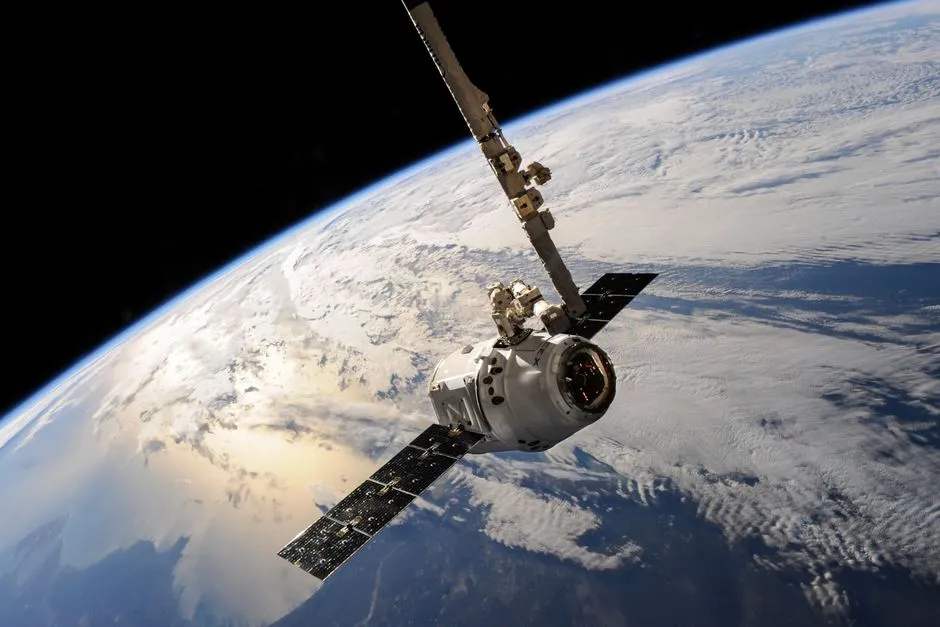
"A satellite glides over Earth showcasing dramatic cloud formations and the vast expanse of space." by SpaceX / Pexels.
Every cloud image you see on television weather forecasts comes from satellites orbiting high above Earth. Weather satellites observe our planet from space to track storms, measure temperatures, and monitor atmospheric conditions. Scientists use data from these satellites to predict weather patterns and warn people about dangerous storms like hurricanes.
Two main types of weather satellites orbit Earth. Geostationary satellites orbit at about 36,000 kilometers above the equator. At this height, they move at the same speed as Earth rotates. This means they stay positioned over one spot on the planet's surface. Geostationary satellites like GOES-East and GOES-West provide continuous images of the same region. They can track storms as they develop and move across an area. Polar-orbiting satellites follow a different path. These satellites travel in low Earth orbit, much closer to the surface at about 850 kilometers high. They pass over both the North and South Poles as Earth rotates beneath them. This orbit pattern allows them to scan the entire planet twice each day. Polar-orbiting satellites capture higher-resolution images than geostationary satellites because they fly closer to Earth's surface.
Weather satellites carry instruments that measure different types of energy. They detect visible light reflected from clouds, land, and oceans during daylight hours. These images look similar to photographs taken from space. Satellites also measure infrared radiation, which is heat energy. Infrared sensors can detect temperature differences in clouds, water, and land surfaces even at night. Warmer objects emit more infrared radiation than cooler objects. Scientists also use satellites to measure water vapor in the atmosphere. Water vapor images show where moisture exists in the air, which helps predict where rain or snow might develop.
Weather satellites provide global coverage that ground-based instruments cannot match. Scientists combine satellite data with information from weather stations, radar systems, and ocean buoys. This combination creates accurate forecasts that help communities prepare for severe weather events. Evidence shows that satellite technology has improved hurricane track predictions significantly over the past 40 years.
Interesting Fact: The GOES-16 satellite, launched in 2016, can take a full image of Earth every 15 minutes and scan specific storm regions every 30 seconds. This rapid imaging helps meteorologists track dangerous weather in near real-time.
Comprehension quiz (10 questions)
1. Where do the cloud images shown on television weather forecasts come from?
2. At what altitude do geostationary satellites orbit Earth?
3. What does the term 'infrared radiation' mean in the context of weather satellites?
4. Why can polar-orbiting satellites capture higher-resolution images than geostationary satellites?
5. How does measuring water vapor in the atmosphere help meteorologists?
6. What advantage do geostationary satellites have over polar-orbiting satellites?
7. Based on the passage, what can scientists infer from infrared satellite images at night?
8. If a meteorologist needed to track a hurricane developing off the coast of Florida in real-time, which type of satellite would be most useful?
9. True or False: Polar-orbiting satellites pass over both the North and South Poles as they orbit Earth.
10. True or False: Weather satellites can only take pictures during daylight hours when visible light is available.
Perfect for the way you teach
- Build comprehension skills
- Auto-graded quiz
- Differentiated reading
- Read together at home
- Improve fluency
- Quiet reading time
- Reading curriculum support
- Independent practice
- Track Lexile growth