How Sonar Maps the Ocean Floor
Interactive passage with audio narration, comprehension questions, and printable PDF.
What's included
How Sonar Maps the Ocean Floor preview and details
About this printable How Sonar Maps the Ocean Floor science reading passage, NGSS-aligned (Grades 6-8)
Sample passage and quiz from How Sonar Maps the Ocean Floor
Reading passage and comprehension quiz preview
How Sonar Maps the Ocean Floor
"Collecting Multibeam Sonar Data" by NOAA's National Ocean Service / Wikimedia Commons
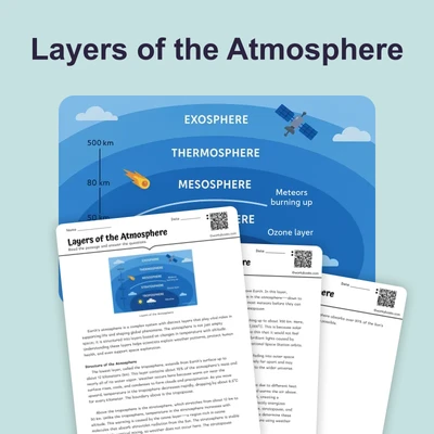
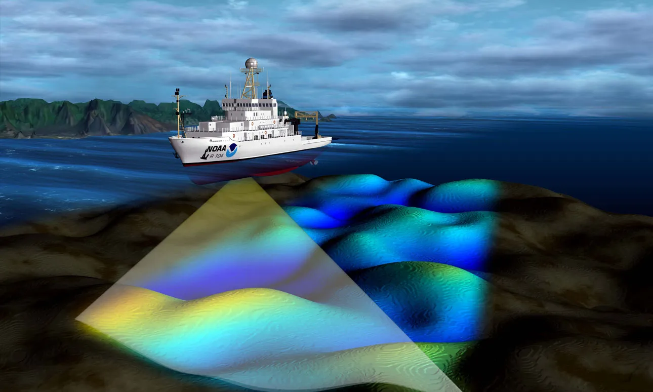
The ocean floor remains one of the least explored places on Earth. More than 80 percent of the ocean floor has never been mapped in detail. Scientists use a technology called sonar to create maps of underwater terrain. Sonar stands for Sound Navigation and Ranging, and it works by sending sound waves through water to measure depth and detect objects.
The basic principle of sonar is similar to how bats navigate in the dark. A ship equipped with sonar sends a pulse of sound energy, called a ping, down toward the ocean floor. When this sound wave hits the bottom, it bounces back to the ship as an echo. Scientists measure the time it takes for the echo to return. Since sound travels through water at a known speed of about 1,500 meters per second, they can calculate the water depth. The formula is simple: depth equals half the round-trip time multiplied by the speed of sound in water.
Modern ships use multibeam sonar systems that send out many sound beams at once in a fan-shaped pattern. This technology creates detailed three-dimensional maps of the seafloor called bathymetric maps. These maps show underwater features just like topographic maps show mountains and valleys on land. Through sonar mapping, scientists discovered surprising features on the ocean floor, including enormous underwater mountain chains called mid-ocean ridges and deep valleys called ocean trenches.
Sonar mapping provided crucial evidence for the theory of plate tectonics. In the 1950s and 1960s, scientists used sonar to map the Mid-Atlantic Ridge, an underwater mountain chain running down the center of the Atlantic Ocean. They discovered that the youngest rocks were at the ridge center, with progressively older rocks farther away. This pattern revealed seafloor spreading, where new ocean floor forms at mid-ocean ridges as tectonic plates move apart. Sonar also revealed deep ocean trenches where one plate slides beneath another, completing the cycle of plate movement.
Today, scientists continue using sonar to explore the ocean floor. Modern autonomous underwater vehicles carry sonar equipment to map areas too deep or dangerous for ships. These maps help scientists understand underwater volcanoes, locate shipwrecks, study marine habitats, and monitor changes in the seafloor over time. Each new sonar survey adds details to our understanding of the dynamic ocean floor.
Interesting Fact: The deepest part of the ocean, the Mariana Trench, reaches nearly 11,000 meters below sea level. If Mount Everest were placed in the trench, its peak would still be over 2,000 meters underwater.
Comprehension quiz (10 questions)
1. What does the acronym SONAR stand for?
2. How does sonar calculate the depth of the ocean floor?
3. At what speed does sound travel through water?
4. In the passage, the word 'echo' refers to:
5. What does 'bathymetric' mean in the context of ocean floor mapping?
6. What pattern did scientists discover when they mapped the Mid-Atlantic Ridge?
7. Based on the passage, what can you infer about the relationship between sonar mapping and the theory of plate tectonics?
8. Why is multibeam sonar more effective than single-beam sonar for mapping the ocean floor?
9. If a ship sends a sonar ping and receives an echo 4 seconds later, and sound travels at 1,500 meters per second in water, what is the approximate depth?
10. True or False: More than 80 percent of the ocean floor has been mapped in detail.
Perfect for the way you teach
- Build comprehension skills
- Auto-graded quiz
- Differentiated reading
- Read together at home
- Improve fluency
- Quiet reading time
- Reading curriculum support
- Independent practice
- Track Lexile growth