Reading PassagePremium

Landslide Mitigation

Interactive passage with audio narration, comprehension questions, and printable PDF.

No ratings yet
Grades 5–8ScienceElaEnglish · SpanishInteractive · Printable
Aligned toMS-ESS3-2MS-ETS1-1
Just this resource
$1.50
One-time purchase
Best value
Unlock everything
$49.99$29.99/yr
40% off until Aug 1 — 10,000+ resources
Renews at $49.99/year.
Unlock above to use these actions

What's included

Reading passage
Audio narration
Comprehension quiz
Writing activity
Glossary & flashcards
Differentiated version
Spanish translation

Landslide Mitigation preview and details

About this printable Landslide Mitigation science reading passage, NGSS-aligned (Grades 5-8)

This informational science passage for middle school students explores landslide mitigation, focusing on the mechanisms and strategies used to reduce the risk of slope failure. Aligned with NGSS MS-ESS3-2 and MS-ETS1-1, the passage covers land-use planning, hazard mapping, engineering solutions such as retaining walls and drainage, the role of vegetation in stabilizing slopes, and the use of monitoring and early warning systems. Students will understand how scientists and engineers use technology and data to predict, prevent, and respond to landslides. The passage is accompanied by a glossary, differentiated reading levels, Spanish translations, comprehension questions, writing prompts, and engaging graphic organizers. Audio integration ensures accessibility for diverse learners. This resource is ideal for teaching earth science, engineering design, and environmental risk management in grades 6-8.
Written by Workybooks TeamPublished by Workybooks
Preview

Sample passage and quiz from Landslide Mitigation

Reading passage and comprehension quiz preview

Landslide Mitigation
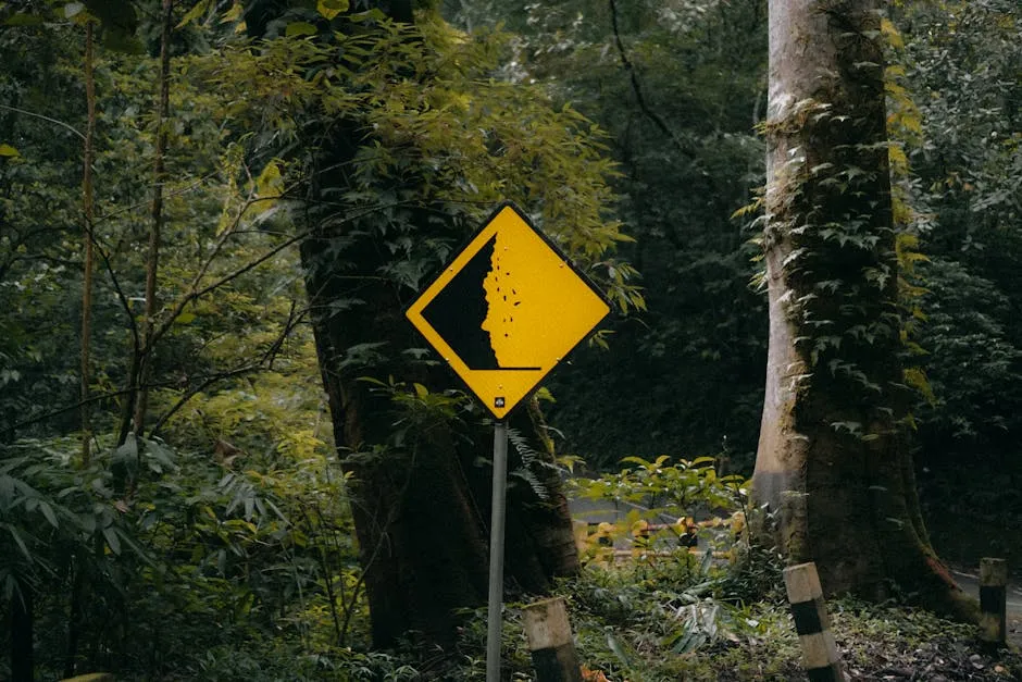
Landslide warning sign in lush green forest, Mojokerto, East Java.

"Landslide warning sign" by WikiImages / Pexels  

Landslides are sudden movements of rock, soil, and debris down a slope, often causing damage to property and putting lives at risk. In regions with steep hillsides or heavy rainfall, landslides occur with alarming frequency. To reduce the hazards, scientists and engineers use a variety of strategies designed to prevent slope failure and protect communities. Understanding the science behind landslide mitigation is vital for keeping people safe and maintaining stable landscapes.

Land-Use Planning and Hazard Mapping
One of the most effective methods to reduce landslide risk is land-use planning. This involves restricting development on unstable slopes and using hazard mapping to identify areas most at risk. Hazard maps are created using data from soil studies, rainfall records, and historical landslide events. By analyzing this information, communities can make informed decisions about where to build new homes, roads, or schools. For example, in California, strict regulations prevent construction on slopes known to be unstable. These scientific approaches have greatly decreased landslide damage in high-risk regions.

Engineering Solutions and Vegetation
When development is necessary on or near a slope, engineers design protective structures to stabilize the ground. Retaining walls hold back soil, while rock bolts anchor loose rock to the underlying bedrock. Slope drainage systems remove excess water, which can weaken soil and trigger slides. Debris basins capture falling rocks and mud before they reach roads or homes. Another key factor is vegetation. Plant roots bind soil together, reducing erosion and helping prevent landslides. Studies show that slopes covered with deep-rooted plants are up to 80% less likely to fail compared to bare ground. This demonstrates the importance of integrating natural solutions with engineering techniques.

Monitoring, Warning, and Response
Modern technology allows for continuous monitoring of slopes using ground movement sensors, inclinometers, GPS, and interferometric radar. These tools detect small changes in ground position or moisture that may signal an impending landslide. Warning signs, such as cracks in the ground, tilting trees, new springs, or bulging soil, are also carefully observed. After wildfires, areas are at higher risk for debris flows because burned vegetation cannot hold soil in place. Early warning systems can alert residents to evacuate if a slide becomes likely. If caught in a landslide, experts recommend moving away from the path and curling into a ball to protect yourself. Afterward, staying away from the slide area and reporting to authorities is crucial for safety and emergency response.

Landslide mitigation is a complex process that combines scientific understanding, engineering, technology, and community planning. By linking these systems, we can significantly reduce the risk of disasters and create safer, more resilient environments.

Interesting Fact: Some landslides can move at speeds greater than 50 miles per hour, making early warning systems essential for saving lives.

Comprehension quiz (10 questions)

1. What is the main purpose of landslide mitigation?

To reduce the risk of slope failure and protect people and property
To increase rainfall in dry areas
To build more houses on hillsides
To remove all vegetation from slopes

2. Which of the following is an example of land-use planning mentioned in the passage?

Restricting development on unstable slopes
Building more houses on hills
Removing hazard maps
Planting only grass on slopes

3. What do retaining walls do?

Hold back soil to prevent it from sliding
Add water to the slope
Remove vegetation from the hillside
Create cracks in the ground

4. What is the role of vegetation in landslide mitigation?

Roots bind soil, reducing erosion and helping prevent landslides
Vegetation removes all water from the slope
It increases the chance of landslides
Plant roots make the ground weaker

5. What does the term "hazard mapping" mean in this passage?

Drawing maps that show areas most at risk for landslides
Building walls around cities
Planting more trees in forests
Removing all rocks from hillsides

6. Which tool can detect small changes in the ground before a landslide occurs?

Ground movement sensor
Water bottle
Shovel
Ladder

7. Why are burned hillsides after wildfires especially at risk for landslides?

Because burned vegetation can no longer hold the soil in place
Because there are more trees
Because fires make the soil stronger
Because rocks become heavier

8. If you see cracks in the ground and tilting trees on a slope, what might that indicate?

Possible warning signs of a landslide
That the slope is completely safe
That the area is good for building
That there is no water nearby

9. True or False: Slope drainage systems add extra water to a hillside.

True
False

10. True or False: Early warning systems can help save lives during landslides.

True
False
Who it's for

Perfect for the way you teach

Teachers
  • Build comprehension skills
  • Auto-graded quiz
  • Differentiated reading
Parents
  • Read together at home
  • Improve fluency
  • Quiet reading time
Homeschoolers
  • Reading curriculum support
  • Independent practice
  • Track Lexile growth
Topics

Reviews & Ratings

No reviews yet. Be the first to share your experience!

More reading you might love

20 more
Passage
Natural Disaster: Earthquake - reading educational content
Grades 4–5

Natural Disaster: Earthquake

weather and climate · RI.3.1

Free
Passage
Obsidian: The Natural Glass Rock - reading educational content
Grades 5–8

Obsidian: The Natural Glass Rock

science · MS-ESS2-3

Free
Passage
All About Seismometers - reading educational content
Grades 5–8

All About Seismometers

science · MS-ESS3-2

Free
Passage
What Is the Difference Between Magma and Lava? - reading educational content
Grades 5–8

What Is the Difference Between Magma and Lava?

science · MS-ESS2-3

$1.50
Passage
Tools and Technology in Earth Science - reading educational content
Grades 5–8

Tools and Technology in Earth Science

science · MS-ESS2-2

$1.50
Passage
Types of Maps  - reading educational content
Grades 5–8

Types of Maps

earth science · MS-ESS2-2

$1.50
Passage
Mass Movements - reading educational content
Grades 5–8

Mass Movements

science · MS-ESS2-1

$1.50
Passage
What Causes Earthquakes? - reading educational content
Grades 5–8

What Causes Earthquakes?

science · MS-ESS2-2

$1.50
Passage
Floods: Causes and Types - reading educational content
Grades 5–8

Floods: Causes and Types

weather and climate · MS-ESS3-2

$1.50
Passage
Hurricanes and Tropical Cyclones - reading educational content
Grades 5–8

Hurricanes and Tropical Cyclones

weather and climate · MS-ESS3-2

$1.50
Passage
Hurricane Preparedness and Safety - reading educational content
Grades 5–8

Hurricane Preparedness and Safety

weather and climate · MS-ESS3-2

$1.50
Passage
Tornadoes - reading educational content
Grades 5–8

Tornadoes

weather and climate · MS-ESS3-2

$1.50
Passage
Tsunamis - reading educational content
Grades 5–8

Tsunamis

science · MS-ESS3-2

$1.50
Passage
Tsunami Warning and Safety - reading educational content
Grades 5–8

Tsunami Warning and Safety

science · MS-ESS3-2

$1.50
Passage
Earthquake Hazards and Damage - reading educational content
Grades 5–8

Earthquake Hazards and Damage

science · MS-ESS3-2

$1.50
Passage
Earthquake Zones and Patterns - reading educational content
Grades 5–8

Earthquake Zones and Patterns

science · MS-ESS2-2

$1.50
Passage
Seismic Waves - reading educational content
Grades 5–8

Seismic Waves

science · MS-ESS2-2

$1.50
Passage
Measuring Earthquakes - reading educational content
Grades 5–8

Measuring Earthquakes

science · MS-ESS2-2

$1.50
Passage
Earthquake Safety and Preparedness - reading educational content
Grades 5–8

Earthquake Safety and Preparedness

science · MS-ESS3-2

$1.50
Passage
Volcanic Eruptions and Products - reading educational content
Grades 5–8

Volcanic Eruptions and Products

science · MS-ESS2-2

$1.50
Copyright © 2026 Workybooks. Made with ♥ in California.