What Is a Watershed
Interactive passage with audio narration, comprehension questions, and printable PDF.
By completing this purchase you agree to our Terms of Use and Privacy Policy. Your subscription renews automatically until you cancel. You can cancel anytime from your account settings. All sales are final and non-refundable. Digital content is available for download in your account immediately upon purchase.
What's included
What Is a Watershed preview and details
About this printable What Is a Watershed science reading passage, NGSS-aligned (Grades 5-8)
Sample passage and quiz from What Is a Watershed
Reading passage and comprehension quiz preview
What Is a Watershed
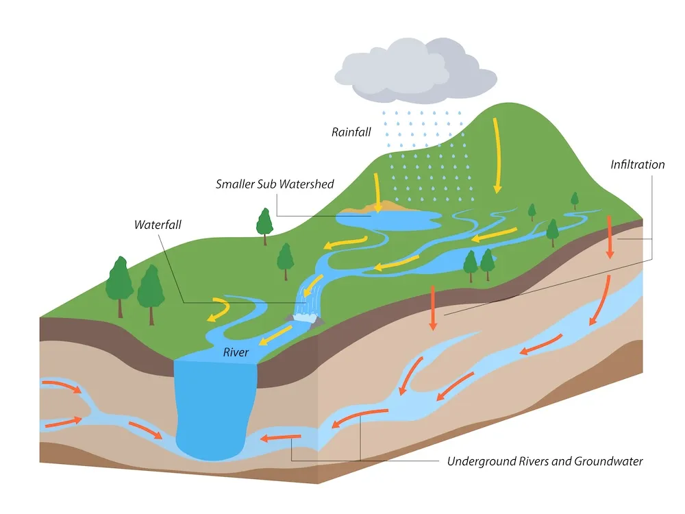
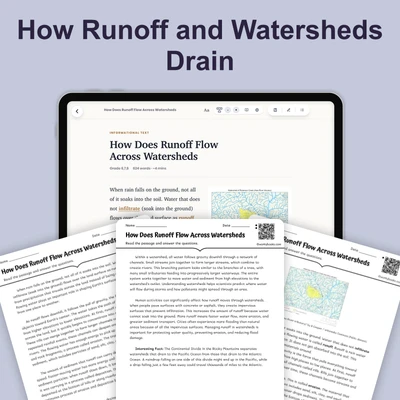
A watershed is the land area that drains water to a specific location. This location can be a river, lake, or ocean. When rain falls on your roof or on a hillside, it flows downhill. The water follows the shape of the land until it reaches a body of water. All the land that contributes water to that destination forms one watershed.
Mountain ridges and hills create natural boundaries between watersheds. Scientists call these boundaries divides. Water that falls on one side of a divide flows to one watershed. Water on the other side flows to a different watershed. Think of a divide like the peak of a roof. Rain landing on the left side runs left, while rain on the right side runs right.
Watersheds can be large or small. A small watershed might drain into a creek that flows through your neighborhood. A large watershed can cover thousands of square miles. The Mississippi River watershed drains about 40 percent of the United States. It collects water from 31 states and channels it to the Gulf of Mexico. The Amazon watershed in South America spans seven countries. It is one of the largest watersheds on Earth.
Every place on land sits within some watershed. Your school, home, and local park all belong to a drainage basin. Evidence shows that water from your roof will eventually reach a specific ocean or lake. The path may be long and complex, but the connection exists. Scientists use watershed maps to track how water moves across the landscape. These maps help them understand how pollution or changes in land use can affect water quality downstream.
Watersheds matter because they connect different parts of Earth's surface through water. Activities in one area can impact water quality far away. For example, fertilizer used on farms in Iowa can travel down the Mississippi River. It may affect water conditions hundreds of miles away in Louisiana. Understanding watersheds helps communities protect their water resources. It also shows how human actions in one location can influence ecosystems in another.
Interesting Fact: The Continental Divide in North America separates watersheds that drain to the Pacific Ocean from those that drain to the Atlantic Ocean. A raindrop falling on one side of this divide may end up in a completely different ocean than a drop falling just a few feet away.
Comprehension quiz (10 questions)
1. What is a watershed?
2. What creates natural boundaries between watersheds?
3. How much of the United States does the Mississippi River watershed drain?
4. What is another term for watershed?
5. Based on the passage, why do watersheds matter to communities?
6. How can fertilizer used in Iowa affect water in Louisiana?
7. What tool do scientists use to track how water moves across the landscape?
8. According to the passage, what happens to rainwater that falls on your roof?
9. True or False: Every place on land sits within some watershed.
10. True or False: The Amazon watershed is located entirely within one country.
Perfect for the way you teach
- Build comprehension skills
- Auto-graded quiz
- Differentiated reading
- Read together at home
- Improve fluency
- Quiet reading time
- Reading curriculum support
- Independent practice
- Track Lexile growth